Caspe night lights from space
Night Light of Caspe (Aragon) from space (Spain) Src. Average luminocity for 10x10km area is 6.4107% and for 50x50km: 1.1127%.
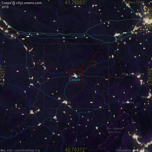
Analysis of Caspe night lights 2016
Square area 10x10 km:
100  0.32%
0.32%
90-99 1.14%
80-89 1.79%
70-79 0.65%
60-69 0.49%
50-59 0.97%
40-49 1.14%
30-39 0.65%
20-29 0.65%
10-19 0%
0-9 92.21%
0.32%90-99
1.14%80-89
1.79%70-79
0.65%60-69
0.49%50-59
0.97%40-49
1.14%30-39
0.65%20-29
0.65%10-19
0%0-9
92.21%Square area 50x50 km:
100 0.05%
90-99 0.15%
80-89 0.24%
70-79 0.21%
60-69 0.24%
50-59 0.1%
40-49 0.16%
30-39 0.08%
20-29 0.12%
10-19 0.03%
0-9 98.61%
0.05%90-99
0.15%80-89
0.24%70-79
0.21%60-69
0.24%50-59
0.1%40-49
0.16%30-39
0.08%20-29
0.12%10-19
0.03%0-9
98.61%Clear (daylight) street map image can be seen on geolist.org.
Map coordinates:
41° 45' 38.3" North, 0° 44' 33.3" West
41° 14' 2.5" North, 0° 2' 22" West
40° 42' 11.2" North, 0° 39' 49.2" East
Some cities around Caspe sort by population:
• Lleida
69.7 km =43.3 mi,  52°
52°
• Tortosa
66.4 km =41.3 mi,  134°
134°
• Alcañiz
21.9 km =13.6 mi,  201°
201°
• Fraga
45.6 km =28.3 mi, 45°
• Andorra
44.6 km =27.7 mi,  230°
230°
• Almacelles
68.1 km =42.3 mi,  35°
35°
• Alcarràs
59.3 km =36.8 mi, 51°
• Alpicat
69 km =42.9 mi, 45°
3125994 (p: 8,054)
Sources (retrieved 2019-11-25):
» Earth at Night: Flat Maps 2012, 2016