Alpicat night lights from space
Night Light of Alpicat (Catalonia) from space (Spain) Src. Average luminocity for 10x10km area is 24.7873% and for 50x50km: 8.765%.
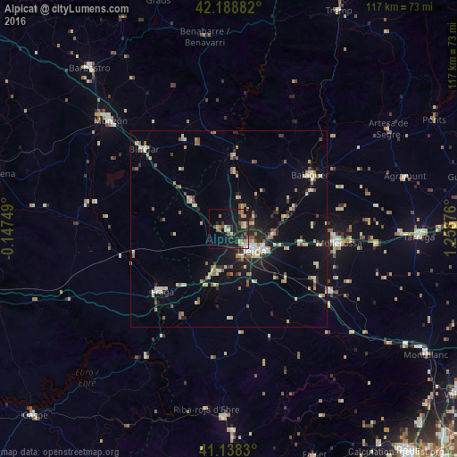
Analysis of Alpicat night lights 2016
Square area 10x10 km:
 2.27%
2.27%90-99
3.73%80-89
2.92%70-79
3.08%60-69
2.27%50-59
4.71%40-49
3.25%30-39
2.27%20-29
11.2%10-19
25.65%0-9
38.64%Square area 50x50 km:
0.68%90-99
1.13%80-89
1.53%70-79
0.95%60-69
1.04%50-59
1.37%40-49
0.76%30-39
0.86%20-29
2.2%10-19
5.47%0-9
84.02%Clear (daylight) street map image can be seen on geolist.org.
Map coordinates:
42° 11' 19.8" North, 0° 8' 51" West
41° 39' 56.5" North, 0° 33' 20.3" East
41° 8' 17.9" North, 1° 15' 31.5" East
Some cities around Alpicat sort by population:
• Lleida
7.8 km =4.8 mi,  134°
134°
• Monzón
40.5 km =25.2 mi,  312°
312°
• Balaguer
25.4 km =15.8 mi,  56°
56°
• Mollerussa
28.8 km =17.9 mi,  97°
97°
• Fraga
23.4 km =14.5 mi,  227°
227°
• Binéfar
29.9 km =18.6 mi, 313°
• Almacelles
12.3 km =7.6 mi, 306°
• Alcarràs
11.5 km =7.1 mi,  196°
196°
3130249 (p: 5,020)
Sources (retrieved 2019-11-25):
» Earth at Night: Flat Maps 2012, 2016