Lleida night lights from space
Night Light of Lleida (Catalonia) from space (Spain) Src. Average luminocity for 10x10km area is 42.4367% and for 50x50km: 9.707%.
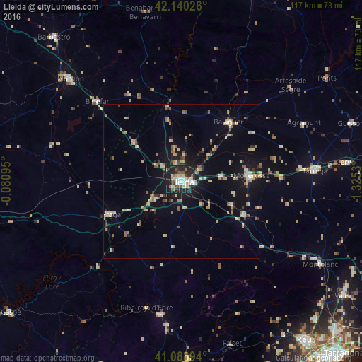
Analysis of Lleida night lights 2016
Square area 10x10 km:
 8.12%
8.12%90-99
8.44%80-89
5.84%70-79
1.3%60-69
4.71%50-59
5.84%40-49
2.44%30-39
4.71%20-29
28.41%10-19
30.19%0-9
0%Square area 50x50 km:
0.84%90-99
1.31%80-89
1.74%70-79
0.94%60-69
1.23%50-59
1.31%40-49
0.8%30-39
0.92%20-29
2.25%10-19
7.08%0-9
81.58%Clear (daylight) street map image can be seen on geolist.org.
Map coordinates:
42° 8' 24.9" North, 0° 4' 51.4" West
41° 37' 0.3" North, 0° 37' 19.8" East
41° 5' 20.2" North, 1° 19' 31.1" East
Some cities around Lleida sort by population:
• Balaguer
24.9 km =15.5 mi,  38°
38°
• Tàrrega
43.1 km =26.8 mi,  85°
85°
• Mollerussa
23.2 km =14.4 mi, 85°
• Fraga
25 km =15.5 mi,  245°
245°
• Binéfar
37.7 km =23.4 mi,  313°
313°
• Almacelles
20 km =12.4 mi, 309°
• Alcarràs
10.4 km =6.5 mi,  237°
237°
• Alpicat
7.8 km =4.8 mi, 314°
3118514 (p: 135,919)
Sources (retrieved 2019-11-25):
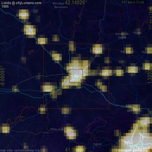
» NASA, Earths city lights 1995
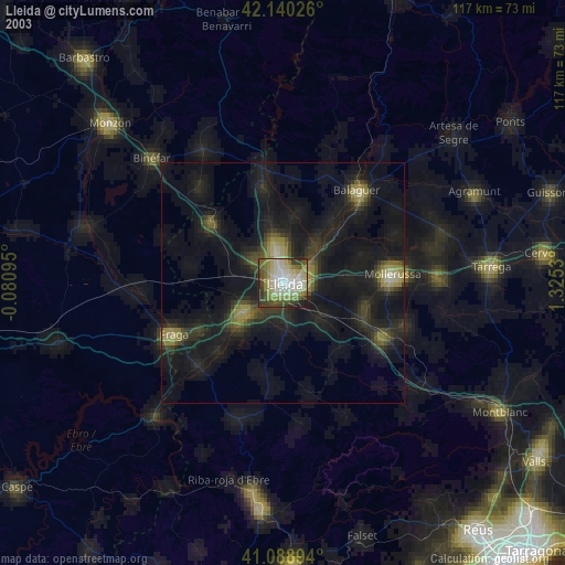
» NASA city lights 2003
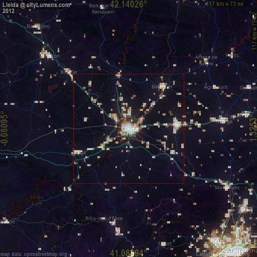
» Earth at Night: Flat Maps 2012, 2016