Balaguer night lights from space
Night Light of Balaguer (Catalonia) from space (Spain) Src. Average luminocity for 10x10km area is 15.1088% and for 50x50km: 8.5059%.
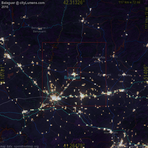
Analysis of Balaguer night lights 2016
Square area 10x10 km:
 1.46%
1.46%90-99
2.27%80-89
3.57%70-79
0.81%60-69
1.95%50-59
2.6%40-49
0.65%30-39
0%20-29
2.44%10-19
4.22%0-9
80.03%Square area 50x50 km:
0.71%90-99
1.05%80-89
1.57%70-79
0.78%60-69
1%50-59
1.07%40-49
0.81%30-39
1.02%20-29
2.21%10-19
6.86%0-9
82.92%Clear (daylight) street map image can be seen on geolist.org.
Map coordinates:
42° 18' 47.7" North, 0° 6' 28.1" East
41° 47' 28.2" North, 0° 48' 39.4" East
41° 15' 53.2" North, 1° 30' 50.6" East
Some cities around Balaguer sort by population:
• Lleida
24.9 km =15.5 mi,  218°
218°
• Tàrrega
31.6 km =19.6 mi,  120°
120°
• Mollerussa
19 km =11.8 mi,  157°
157°
• Cervera
40.6 km =25.2 mi,  109°
109°
• Almacelles
31.7 km =19.7 mi,  258°
258°
• Agramunt
23.7 km =14.7 mi,  91°
91°
• Alcarràs
34.9 km =21.7 mi, 224°
• Alpicat
25.4 km =15.8 mi,  236°
236°
3128978 (p: 16,779)
Sources (retrieved 2019-11-25):
» Earth at Night: Flat Maps 2012, 2016