Tàrrega night lights from space
Night Light of Tàrrega (Catalonia) from space (Spain) Src. Average luminocity for 10x10km area is 18.7159% and for 50x50km: 6.1364%.
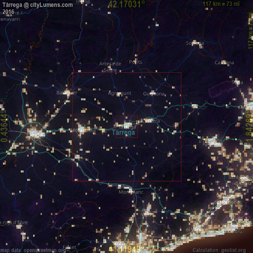
Analysis of Tàrrega night lights 2016
Square area 10x10 km:
 1.46%
1.46%90-99
3.41%80-89
5.68%70-79
1.3%60-69
2.92%50-59
0.81%40-49
0%30-39
0.16%20-29
1.14%10-19
13.47%0-9
69.64%Square area 50x50 km:
0.44%90-99
0.74%80-89
1.25%70-79
0.57%60-69
0.99%50-59
0.62%40-49
0.76%30-39
0.55%20-29
0.67%10-19
3.38%0-9
90.03%Clear (daylight) street map image can be seen on geolist.org.
Map coordinates:
42° 10' 13.1" North, 0° 26' 11.2" East
41° 38' 49.3" North, 1° 8' 22.5" East
41° 7' 10.2" North, 1° 50' 33.7" East
Some cities around Tàrrega sort by population:
• Igualada
40.4 km =25.1 mi,  100°
100°
• Valls
41.2 km =25.6 mi,  167°
167°
• Balaguer
31.6 km =19.6 mi,  300°
300°
• Mollerussa
20 km =12.4 mi,  265°
265°
• Vilanova del Camí
42.2 km =26.2 mi, 101°
• Cervera
11.3 km =7 mi,  76°
76°
• Montblanc
30.2 km =18.8 mi,  176°
176°
• Agramunt
15.9 km =9.9 mi,  347°
347°
3108285 (p: 16,539)
Sources (retrieved 2019-11-25):
» Earth at Night: Flat Maps 2012, 2016