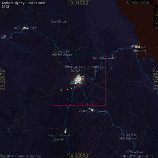
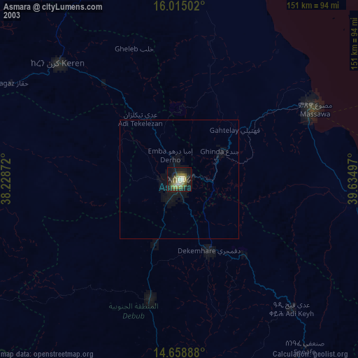
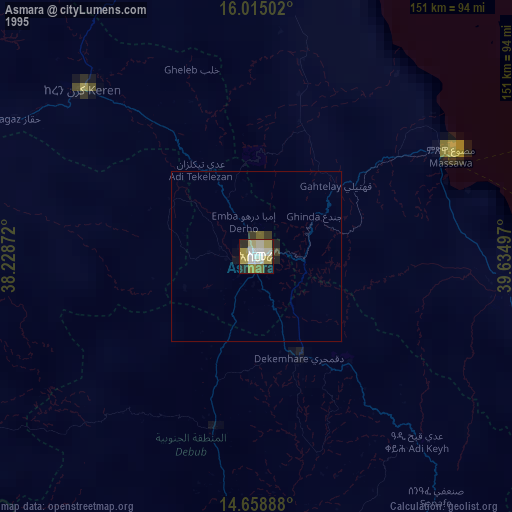
Asmara night lights from space
Night Light of Asmara (Maekel) from space (Eritrea) Src. Average luminocity for 10x10km area is 29.3918% and for 50x50km: 1.4813%.
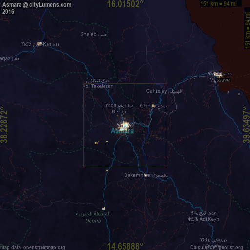
Analysis of Asmara night lights 2016
Square area 10x10 km:
 1.73%
1.73%90-99
4.55%80-89
7.58%70-79
7.14%60-69
2.6%50-59
0.65%40-49
2.38%30-39
6.28%20-29
3.9%10-19
25.32%0-9
37.88%Square area 50x50 km:
0.07%90-99
0.18%80-89
0.36%70-79
0.31%60-69
0.1%50-59
0.03%40-49
0.16%30-39
0.36%20-29
0.27%10-19
1.04%0-9
97.14%Clear (daylight) street map image can be seen on geolist.org.
Map coordinates:
16° 0' 54.1" North, 38° 13' 43.4" East
15° 20' 17" North, 38° 55' 54.6" East
14° 39' 32" North, 39° 38' 5.9" East
Some cities around Asmara sort by population:
• Keren
71 km =44.1 mi,  313°
313°
• Ādīgrat, ET
131 km =81.4 mi,  154°
154°
• Axum, ET
137.2 km =85.3 mi,  189°
189°
• Massawa
65.5 km =40.7 mi,  62°
62°
• Mendefera
51.7 km =32.1 mi, 194°
• Adi Keyh
72.8 km =45.2 mi,  138°
138°
• Dek’emhāre
32.3 km =20.1 mi,  157°
157°
• Ak’ordat
114.8 km =71.3 mi,  281°
281°
343300 (p: 563,930)
Sources (retrieved 2019-11-25):
» NASA, Earths city lights 1995
» NASA city lights 2003
» Earth at Night: Flat Maps 2012, 2016