‘Izbat al Burj night lights from space
Night Light of ‘Izbat al Burj (Dakahlia) from space (Egypt) Src. Average luminocity for 10x10km area is 36.4318% and for 50x50km: 17.7404%.

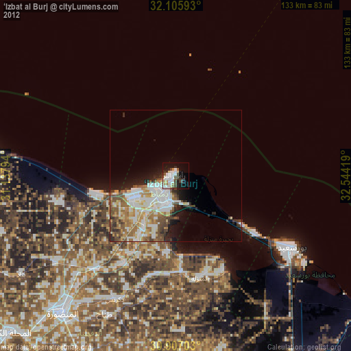
Analysis of ‘Izbat al Burj night lights 2016
Square area 10x10 km:
 7.87%
7.87%90-99
7.52%80-89
6.29%70-79
2.1%60-69
3.32%50-59
4.9%40-49
1.75%30-39
4.55%20-29
11.54%10-19
23.78%0-9
26.4%Square area 50x50 km:
2.71%90-99
3.45%80-89
3.63%70-79
2.08%60-69
2.82%50-59
3.37%40-49
2.39%30-39
1.9%20-29
3.08%10-19
4.39%0-9
70.17%Clear (daylight) street map image can be seen on geolist.org.
Map coordinates:
32° 6' 21.3" North, 31° 8' 16.6" East
31° 30' 30.2" North, 31° 50' 27.8" East
30° 54' 25.3" North, 32° 32' 39.1" East
Some cities around ‘Izbat al Burj sort by population:
• Al Maţarīyah
40.4 km =25.1 mi,  153°
153°
• Damietta
10.6 km =6.6 mi,  194°
194°
• Al Jammālīyah
36.5 km =22.7 mi,  176°
176°
• Al Manzalah
40 km =24.9 mi,  166°
166°
• Fāraskūr
23.2 km =14.4 mi,  211°
211°
• Minyat an Naşr
46.5 km =28.9 mi,  203°
203°
• Shirbīn
45.9 km =28.5 mi,  220°
220°
• Az Zarqā
38.6 km =24 mi, 210°
355392 (p: 37,953)
Sources (retrieved 2019-11-25):
» Earth at Night: Flat Maps 2012, 2016