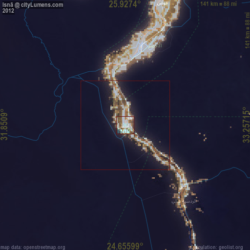
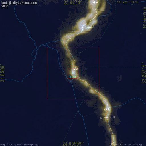
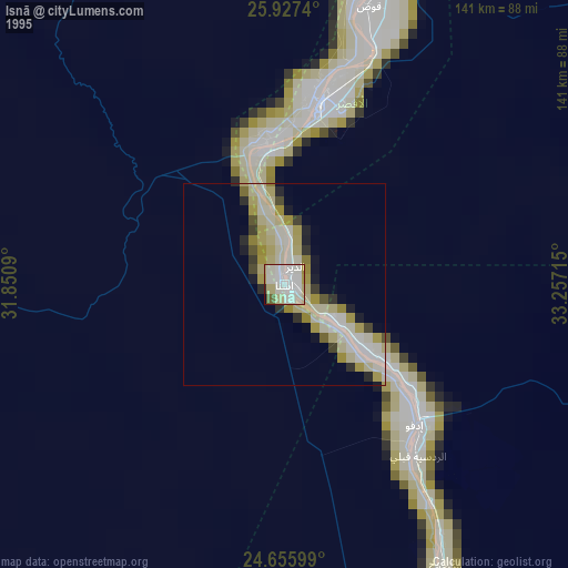
Isnā night lights from space
Night Light of Isnā (Qena) from space (Egypt) Src. Average luminocity for 10x10km area is 77.6766% and for 50x50km: 14.1618%.

Analysis of Isnā night lights 2016
Square area 10x10 km:
 22.22%
90-99
23.81%80-89
7.94%70-79
7.54%60-69
12.1%50-59
14.88%40-49
4.76%30-39
1.19%20-29
4.76%10-19
0.79%0-9
0%Square area 50x50 km:
2%90-99
2.46%80-89
1.18%70-79
1.47%60-69
1.76%50-59
2.38%40-49
3.9%30-39
2.06%20-29
3.86%10-19
9.63%0-9
69.28%Clear (daylight) street map image can be seen on geolist.org.
Map coordinates:
25° 55' 38.6" North, 31° 51' 3.2" East
25° 17' 36.1" North, 32° 33' 14.5" East
24° 39' 21.6" North, 33° 15' 25.7" East
Some cities around Isnā sort by population:
• Luxor
46 km =28.6 mi,  11°
11°
• Qinā
98.4 km =61.1 mi, 10°
• Idfū
47.7 km =29.6 mi,  137°
137°
• Kousa
72.3 km =44.9 mi,  16°
16°
• Kawm Umbū
99 km =61.5 mi,  156°
156°
• Dishnā
92.8 km =57.7 mi,  355°
355°
• Farshūţ
93.3 km =58 mi,  335°
335°
• Naja' Ḥammādī
89.7 km =55.7 mi, 339°
355449 (p: 69,335)
Sources (retrieved 2019-11-25):
» NASA, Earths city lights 1995
» NASA city lights 2003
» Earth at Night: Flat Maps 2012, 2016