Bilqās night lights from space
Night Light of Bilqās (Dakahlia) from space (Egypt) Src. Average luminocity for 10x10km area is 65.8095% and for 50x50km: 60.5588%.
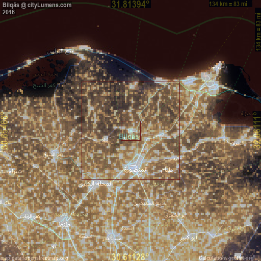
Analysis of Bilqās night lights 2016
Square area 10x10 km:
 6.23%
6.23%90-99
10.26%80-89
13%70-79
11.54%60-69
11.17%50-59
22.34%40-49
19.41%30-39
5.86%20-29
0.18%10-19
0%0-9
0%Square area 50x50 km:
5.41%90-99
8.02%80-89
11.04%70-79
9.11%60-69
12.06%50-59
16.57%40-49
20.17%30-39
12.55%20-29
4.64%10-19
0.43%0-9
0%Clear (daylight) street map image can be seen on geolist.org.
Map coordinates:
31° 48' 50.2" North, 30° 39' 17.5" East
31° 12' 52.3" North, 31° 21' 28.7" East
30° 36' 40.6" North, 32° 3' 40" East
Some cities around Bilqās sort by population:
• Al Manşūrah
19.9 km =12.4 mi,  173°
173°
• Ţalkhā
18 km =11.2 mi, 173°
• Dikirnis
26.5 km =16.5 mi,  121°
121°
• Minyat an Naşr
28.8 km =17.9 mi,  109°
109°
• Samannūd
30.3 km =18.8 mi,  201°
201°
• Shirbīn
15.9 km =9.9 mi,  97°
97°
• Al Ḩāmūl
22.7 km =14.1 mi,  298°
298°
• Az Zarqā
26.4 km =16.4 mi,  91°
91°
358821 (p: 103,596)
Sources (retrieved 2019-11-25):
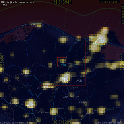
» NASA, Earths city lights 1995
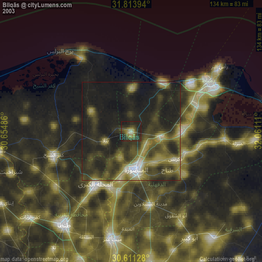
» NASA city lights 2003
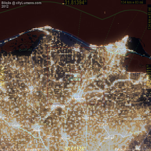
» Earth at Night: Flat Maps 2012, 2016