Al Quşayr night lights from space
Night Light of Al Quşayr (Red Sea) from space (Egypt) Src. Average luminocity for 10x10km area is 25.131% and for 50x50km: 1.4453%.
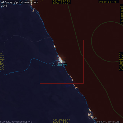

Analysis of Al Quşayr night lights 2016
Square area 10x10 km:
 5.16%
5.16%90-99
5.95%80-89
4.76%70-79
0.79%60-69
2.38%50-59
0.79%40-49
1.59%30-39
2.78%20-29
2.38%10-19
23.21%0-9
50.2%Square area 50x50 km:
0.22%90-99
0.25%80-89
0.19%70-79
0.03%60-69
0.12%50-59
0.12%40-49
0.33%30-39
0.22%20-29
0.19%10-19
1.07%0-9
97.26%Clear (daylight) street map image can be seen on geolist.org.
Map coordinates:
26° 44' 2.2" North, 33° 34' 29.3" East
26° 6' 22" North, 34° 16' 37.8" East
25° 28' 16.2" North, 34° 58' 51.8" East
Some cities around Al Quşayr sort by population:
• Luxor
169.7 km =105.4 mi,  254°
254°
• Qinā
154.9 km =96.3 mi,  272°
272°
• Hurghada
136.1 km =84.6 mi,  340°
340°
• Kousa
152.8 km =94.9 mi,  262°
262°
• Dishnā
179.8 km =111.7 mi, 270°
• Safaga
79 km =49.1 mi,  334°
334°
• El Gouna
155.1 km =96.4 mi, 337°
• Marsa Alam
131.3 km =81.6 mi,  152°
152°
360531 (p: 24,653)
Sources (retrieved 2019-11-25):
» Earth at Night: Flat Maps 2012, 2016