Zaruma night lights from space
Night Light of Zaruma (El Oro) from space (Ecuador) Src. Average luminocity for 10x10km area is 29.5584% and for 50x50km: 3.3516%.
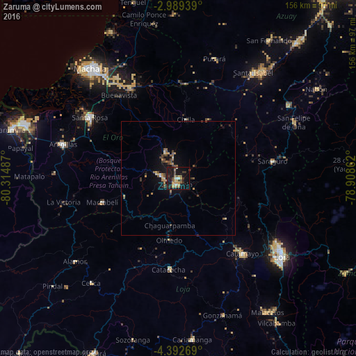
Analysis of Zaruma night lights 2016
Square area 10x10 km:
 1.73%
1.73%90-99
2.6%80-89
2.38%70-79
9.31%60-69
2.81%50-59
4.55%40-49
4.33%30-39
5.19%20-29
5.84%10-19
40.69%0-9
20.56%Square area 50x50 km:
0.12%90-99
0.12%80-89
0.36%70-79
0.71%60-69
0.55%50-59
0.6%40-49
0.73%30-39
0.64%20-29
0.44%10-19
3.41%0-9
92.32%Clear (daylight) street map image can be seen on geolist.org.
Map coordinates:
2° 59' 21.8" South, 80° 18' 53.5" West
3° 41' 28.8" South, 79° 36' 42.3" West
4° 23' 33.7" South, 78° 54' 31" West
Some cities around Zaruma sort by population:
• Loja
56.3 km =35 mi,  126°
126°
• Pasaje
46.1 km =28.6 mi,  331°
331°
• Santa Rosa
47.1 km =29.3 mi,  304°
304°
• Catamayo
43.2 km =26.8 mi,  139°
139°
• Piñas
7.8 km =4.8 mi,  278°
278°
• Catacocha
40.1 km =24.9 mi,  185°
185°
• Portovelo
3.5 km =2.2 mi,  198°
198°
• Celica
59.6 km =37 mi,  219°
219°
3649914 (p: 12,505)
Sources (retrieved 2019-11-25):
» Earth at Night: Flat Maps 2012, 2016