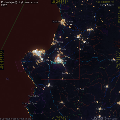
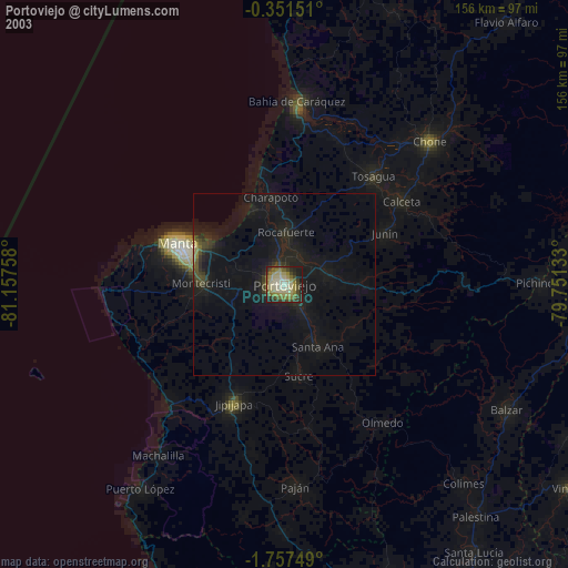
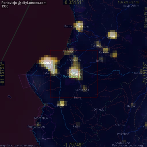
Portoviejo night lights from space
Night Light of Portoviejo (Manabí) from space (Ecuador) Src. Average luminocity for 10x10km area is 65.2035% and for 50x50km: 11.8111%.
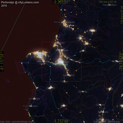
Analysis of Portoviejo night lights 2016
Square area 10x10 km:
 18.18%
90-99
17.32%80-89
10.39%70-79
7.58%60-69
3.46%50-59
1.73%40-49
8.66%30-39
9.52%20-29
20.56%10-19
2.6%0-9
0%Square area 50x50 km:
0.8%90-99
1.04%80-89
1.74%70-79
1.72%60-69
2.34%50-59
1.07%40-49
2.45%30-39
2.53%20-29
3.23%10-19
9.43%0-9
73.65%Clear (daylight) street map image can be seen on geolist.org.
Map coordinates:
0° 21' 5.4" South, 81° 9' 27.3" West
1° 3' 16.5" South, 80° 27' 16" West
1° 45' 27" South, 79° 45' 4.8" West
Some cities around Portoviejo sort by population:
• Manta
30.5 km =19 mi,  289°
289°
• Jipijapa
35.5 km =22.1 mi,  202°
202°
• Montecristi
22.7 km =14.1 mi,  272°
272°
• Sucre
25.3 km =15.7 mi,  171°
171°
• Tosagua
38.5 km =23.9 mi,  39°
39°
• Santa Ana
19.3 km =12 mi,  151°
151°
• Rocafuerte
14.6 km =9.1 mi,  2°
2°
• Junín
31 km =19.3 mi,  62°
62°
3652941 (p: 170,326)
Sources (retrieved 2019-11-25):
» NASA, Earths city lights 1995
» NASA city lights 2003
» Earth at Night: Flat Maps 2012, 2016