Manta night lights from space
Night Light of Manta (Manabí) from space (Ecuador) Src. Average luminocity for 10x10km area is 67.381% and for 50x50km: 9.8492%.
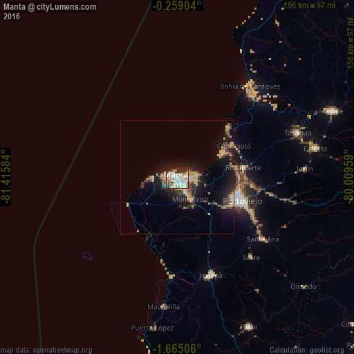
Analysis of Manta night lights 2016
Square area 10x10 km:
 14.94%
90-99
20.13%80-89
10.39%70-79
11.69%60-69
7.36%50-59
1.3%40-49
7.79%30-39
6.06%20-29
13.2%10-19
7.14%0-9
0%Square area 50x50 km:
0.78%90-99
1.07%80-89
1.65%70-79
1.77%60-69
1.61%50-59
0.48%40-49
1.48%30-39
1.96%20-29
2.63%10-19
8.63%0-9
77.95%Clear (daylight) street map image can be seen on geolist.org.
Map coordinates:
0° 15' 32.5" South, 81° 24' 57" West
0° 57' 43.6" South, 80° 42' 45.8" West
1° 39' 54.2" South, 80° 0' 34.5" West
Some cities around Manta sort by population:
• Portoviejo
30.5 km =19 mi,  109°
109°
• Bahía de Caráquez
51.7 km =32.1 mi,  38°
38°
• Jipijapa
45.5 km =28.3 mi,  160°
160°
• Montecristi
11.1 km =6.9 mi,  147°
147°
• Sucre
48.1 km =29.9 mi,  137°
137°
• Santa Ana
46.7 km =29 mi,  125°
125°
• Rocafuerte
29.6 km =18.4 mi,  81°
81°
• Junín
56.5 km =35.1 mi,  86°
86°
3654410 (p: 183,166)
Sources (retrieved 2019-11-25):
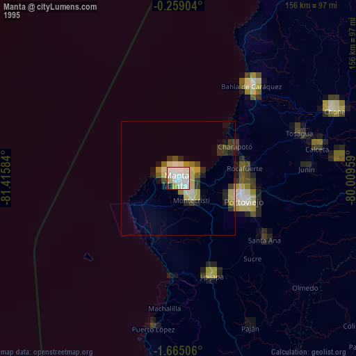
» NASA, Earths city lights 1995
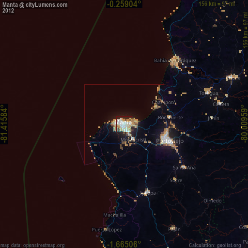
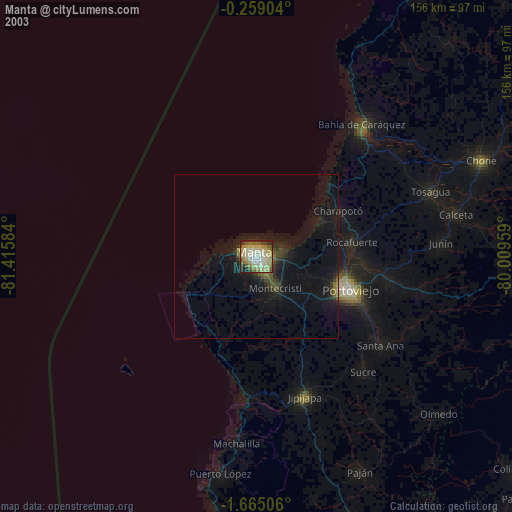
» NASA city lights 2003
» Earth at Night: Flat Maps 2012, 2016