Junín night lights from space
Night Light of Junín (Manabí) from space (Ecuador) Src. Average luminocity for 10x10km area is 6.632% and for 50x50km: 4.6591%.
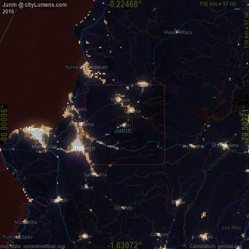
Analysis of Junín night lights 2016
Square area 10x10 km:
 0.43%
0.43%90-99
0.43%80-89
0%70-79
1.73%60-69
0.87%50-59
0%40-49
1.52%30-39
4.11%20-29
0.43%10-19
1.73%0-9
88.74%Square area 50x50 km:
0.1%90-99
0.15%80-89
0.54%70-79
0.55%60-69
0.84%50-59
0.45%40-49
1.19%30-39
1.3%20-29
1.47%10-19
3.81%0-9
89.61%Clear (daylight) street map image can be seen on geolist.org.
Map coordinates:
0° 13' 28.8" South, 80° 54' 32.3" West
0° 55' 40" South, 80° 12' 21" West
1° 37' 50.6" South, 79° 30' 9.8" West
Some cities around Junín sort by population:
• Portoviejo
31 km =19.3 mi,  242°
242°
• Chone
28.4 km =17.6 mi,  26°
26°
• Bahía de Caráquez
44 km =27.3 mi,  326°
326°
• Calceta
10.2 km =6.3 mi, 27°
• Sucre
45.7 km =28.4 mi,  211°
211°
• Tosagua
16 km =9.9 mi,  348°
348°
• Santa Ana
36.1 km =22.4 mi, 210°
• Rocafuerte
27.1 km =16.8 mi,  270°
270°
3655385 (p: 9,128)
Sources (retrieved 2019-11-25):
» Earth at Night: Flat Maps 2012, 2016