San Miguel night lights from space
Night Light of San Miguel (Bolívar) from space (Ecuador) Src. Average luminocity for 10x10km area is 23.9372% and for 50x50km: 3.4333%.
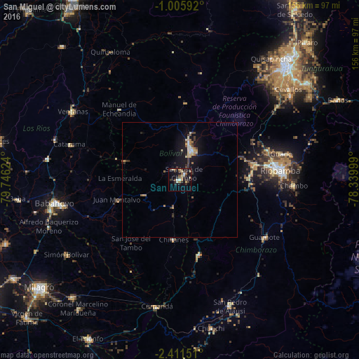
Analysis of San Miguel night lights 2016
Square area 10x10 km:
 1.3%
1.3%90-99
2.6%80-89
5.63%70-79
1.73%60-69
3.68%50-59
2.38%40-49
4.55%30-39
7.14%20-29
4.76%10-19
19.26%0-9
46.97%Square area 50x50 km:
0.2%90-99
0.29%80-89
0.74%70-79
0.29%60-69
0.51%50-59
0.29%40-49
0.49%30-39
0.77%20-29
0.55%10-19
3.77%0-9
92.11%Clear (daylight) street map image can be seen on geolist.org.
Map coordinates:
1° 0' 21.3" South, 79° 44' 46.5" West
1° 42' 31.8" South, 79° 2' 35.2" West
2° 24' 41.4" South, 78° 20' 24" West
Some cities around San Miguel sort by population:
• Riobamba
44.2 km =27.5 mi,  84°
84°
• Babahoyo
55.6 km =34.5 mi,  259°
259°
• Ventanas
55 km =34.2 mi,  302°
302°
• Guaranda
13.7 km =8.5 mi,  19°
19°
• Montalvo
28.6 km =17.8 mi,  251°
251°
• Guano
47.2 km =29.3 mi, 76°
• Alfredo Baquerizo Moreno
57.5 km =35.7 mi, 246°
• Catarama
48.7 km =30.3 mi,  287°
287°
3651639 (p: 12,575)
Sources (retrieved 2019-11-25):
» Earth at Night: Flat Maps 2012, 2016