Guaranda night lights from space
Night Light of Guaranda (Bolívar) from space (Ecuador) Src. Average luminocity for 10x10km area is 34.0216% and for 50x50km: 3.8111%.
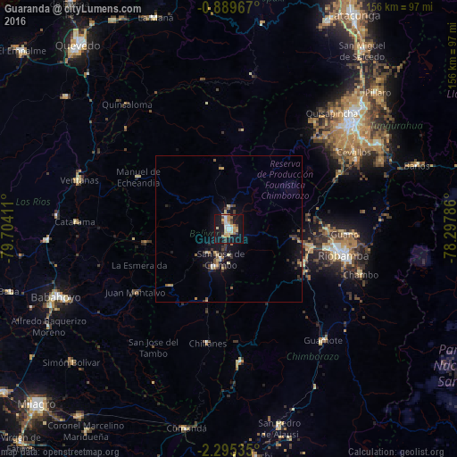
Analysis of Guaranda night lights 2016
Square area 10x10 km:
 3.68%
3.68%90-99
4.55%80-89
10.39%70-79
3.25%60-69
5.41%50-59
0.65%40-49
2.6%30-39
4.55%20-29
0.65%10-19
51.3%0-9
12.99%Square area 50x50 km:
0.2%90-99
0.29%80-89
0.82%70-79
0.33%60-69
0.51%50-59
0.44%40-49
0.48%30-39
0.94%20-29
0.48%10-19
4.31%0-9
91.21%Clear (daylight) street map image can be seen on geolist.org.
Map coordinates:
0° 53' 22.8" South, 79° 42' 14.8" West
1° 35' 33.5" South, 79° 0' 3.5" West
2° 17' 43.3" South, 78° 17' 52.3" West
Some cities around Guaranda sort by population:
• Ambato
57.3 km =35.6 mi,  48°
48°
• Riobamba
40.3 km =25 mi,  102°
102°
• Ventanas
53.7 km =33.4 mi,  288°
288°
• Pelileo
58.7 km =36.5 mi,  60°
60°
• Montalvo
38.7 km =24 mi,  235°
235°
• Guano
41.2 km =25.6 mi,  92°
92°
• San Miguel
13.7 km =8.5 mi,  199°
199°
• Catarama
51.1 km =31.8 mi,  272°
272°
3657571 (p: 22,199)
Sources (retrieved 2019-11-25):
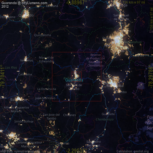
» Earth at Night: Flat Maps 2012, 2016