Pujilí night lights from space
Night Light of Pujilí (Cotopaxi) from space (Ecuador) Src. Average luminocity for 10x10km area is 34.0693% and for 50x50km: 12.5615%.
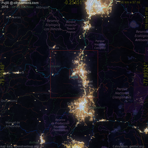
Analysis of Pujilí night lights 2016
Square area 10x10 km:
 2.38%
2.38%90-99
2.81%80-89
2.81%70-79
4.11%60-69
13.85%50-59
2.81%40-49
6.71%30-39
8.87%20-29
10.82%10-19
22.73%0-9
22.08%Square area 50x50 km:
0.59%90-99
0.7%80-89
1.01%70-79
1.96%60-69
4.34%50-59
1.53%40-49
2.72%30-39
3.19%20-29
4.26%10-19
9.35%0-9
70.36%Clear (daylight) street map image can be seen on geolist.org.
Map coordinates:
0° 15' 16.2" South, 79° 23' 58.2" West
0° 57' 27.3" South, 78° 41' 46.9" West
1° 39' 37.9" South, 77° 59' 35.7" West
Some cities around Pujilí sort by population:
• Ambato
33.6 km =20.9 mi,  164°
164°
• Latacunga
9.3 km =5.8 mi,  74°
74°
• Machachi
51.8 km =32.2 mi,  16°
16°
• Pelileo
44.8 km =27.8 mi, 157°
• La Maná
58.8 km =36.5 mi,  271°
271°
• San Miguel de Salcedo
15.3 km =9.5 mi,  129°
129°
• Baños
57.5 km =35.7 mi,  148°
148°
• Píllaro
29.3 km =18.2 mi, 145°
3652684 (p: 16,168)
Sources (retrieved 2019-11-25):
» Earth at Night: Flat Maps 2012, 2016