La Maná night lights from space
Night Light of La Maná (Cotopaxi) from space (Ecuador) Src. Average luminocity for 10x10km area is 9.8961% and for 50x50km: 2.0353%.
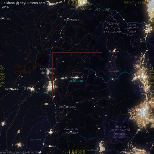
Analysis of La Maná night lights 2016
Square area 10x10 km:
 0.87%
0.87%90-99
1.73%80-89
1.73%70-79
0%60-69
0.87%50-59
2.6%40-49
0.87%30-39
4.33%20-29
0.87%10-19
1.52%0-9
84.63%Square area 50x50 km:
0.12%90-99
0.21%80-89
0.17%70-79
0.25%60-69
0.32%50-59
0.28%40-49
0.3%30-39
0.58%20-29
0.51%10-19
1.36%0-9
95.9%Clear (daylight) street map image can be seen on geolist.org.
Map coordinates:
0° 14' 16.3" South, 79° 55' 41.5" West
0° 56' 27.4" South, 79° 13' 30.2" West
1° 38' 38" South, 78° 31' 19" West
Some cities around La Maná sort by population:
• Ambato
75.8 km =47.1 mi,  116°
116°
• Quevedo
28.2 km =17.5 mi,  249°
249°
• Latacunga
67.8 km =42.1 mi,  89°
89°
• Velasco Ibarra
47.3 km =29.4 mi,  256°
256°
• Ventanas
61.5 km =38.2 mi,  205°
205°
• Pujilí
58.8 km =36.5 mi, 91°
• San Miguel de Salcedo
71.5 km =44.4 mi,  99°
99°
• Catarama
75.2 km =46.7 mi,  200°
200°
3655117 (p: 16,450)
Sources (retrieved 2019-11-25):
» Earth at Night: Flat Maps 2012, 2016