Píllaro night lights from space
Night Light of Píllaro (Tungurahua) from space (Ecuador) Src. Average luminocity for 10x10km area is 49.4697% and for 50x50km: 20.7162%.
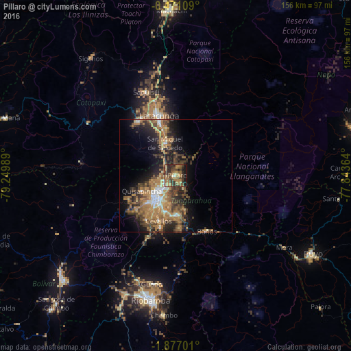
Analysis of Píllaro night lights 2016
Square area 10x10 km:
 1.3%
1.3%90-99
2.81%80-89
6.28%70-79
10.61%60-69
21%50-59
7.14%40-49
13.85%30-39
10.82%20-29
11.9%10-19
14.29%0-9
0%Square area 50x50 km:
1.41%90-99
1.81%80-89
2.1%70-79
3.63%60-69
7.23%50-59
2.91%40-49
4.6%30-39
4.32%20-29
5.01%10-19
9.63%0-9
57.36%Clear (daylight) street map image can be seen on geolist.org.
Map coordinates:
0° 28' 15.9" South, 79° 14' 59.6" West
1° 10' 26.9" South, 78° 32' 48.3" West
1° 52' 37.2" South, 77° 50' 37.1" West
Some cities around Píllaro sort by population:
• Ambato
11.4 km =7.1 mi,  223°
223°
• Riobamba
56.4 km =35 mi,  191°
191°
• Latacunga
27.6 km =17.1 mi,  343°
343°
• Pelileo
17.3 km =10.7 mi,  178°
178°
• Pujilí
29.3 km =18.2 mi,  325°
325°
• Guano
49.1 km =30.5 mi, 190°
• San Miguel de Salcedo
15.1 km =9.4 mi, 341°
• Baños
28.3 km =17.6 mi,  150°
150°
3653159 (p: 7,462)
Sources (retrieved 2019-11-25):
» Earth at Night: Flat Maps 2012, 2016