Palora night lights from space
Night Light of Palora (Morona-Santiago) from space (Ecuador) Src. Average luminocity for 10x10km area is 2.5% and for 50x50km: 1.2433%.
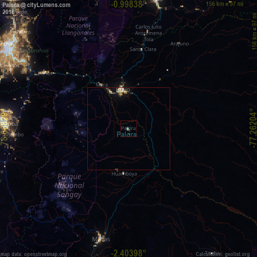
Analysis of Palora night lights 2016
Square area 10x10 km:
100  0%
0%
90-99 0%
80-89 0.87%
70-79 0.87%
60-69 0%
50-59 0%
40-49 0%
30-39 0.65%
20-29 1.95%
10-19 0.87%
0-9 94.81%
0%90-99
0%80-89
0.87%70-79
0.87%60-69
0%50-59
0%40-49
0%30-39
0.65%20-29
1.95%10-19
0.87%0-9
94.81%Square area 50x50 km:
100 0.07%
90-99 0.05%
80-89 0.33%
70-79 0.32%
60-69 0.13%
50-59 0%
40-49 0.18%
30-39 0.3%
20-29 0.17%
10-19 0.87%
0-9 97.57%
0.07%90-99
0.05%80-89
0.33%70-79
0.32%60-69
0.13%50-59
0%40-49
0.18%30-39
0.3%20-29
0.17%10-19
0.87%0-9
97.57%Clear (daylight) street map image can be seen on geolist.org.
Map coordinates:
0° 59' 54.2" South, 78° 40' 5.8" West
1° 42' 4.7" South, 77° 57' 54.6" West
2° 24' 14.3" South, 77° 15' 43.3" West
Some cities around Palora sort by population:
• Riobamba
75.9 km =47.2 mi,  272°
272°
• Puyo
24.6 km =15.3 mi,  350°
350°
• Macas
69.5 km =43.2 mi,  193°
193°
• Tena
80.5 km =50 mi,  12°
12°
• Pelileo
76.4 km =47.5 mi,  302°
302°
• Guano
74.7 km =46.4 mi,  277°
277°
• Baños
61.1 km =38 mi, 303°
• Sucúa
87.3 km =54.2 mi,  195°
195°
3653523 (p: 6,472)
Sources (retrieved 2019-11-25):
» Earth at Night: Flat Maps 2012, 2016