Baláo night lights from space
Night Light of Baláo (Guayas) from space (Ecuador) Src. Average luminocity for 10x10km area is 2.132% and for 50x50km: 1.3253%.
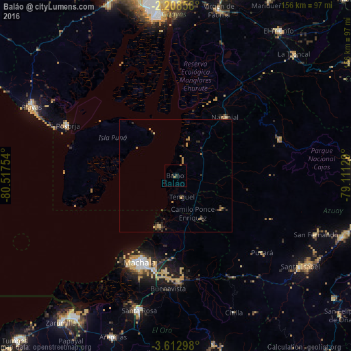
Analysis of Baláo night lights 2016
Square area 10x10 km:
 0%
0%90-99
0%80-89
0%70-79
0.87%60-69
0.43%50-59
0%40-49
0.87%30-39
0.87%20-29
0.87%10-19
0%0-9
96.1%Square area 50x50 km:
0%90-99
0%80-89
0.2%70-79
0.43%60-69
0.2%50-59
0.13%40-49
0.31%30-39
0.42%20-29
0.49%10-19
0.24%0-9
97.57%Clear (daylight) street map image can be seen on geolist.org.
Map coordinates:
2° 12' 30.9" South, 80° 31' 3.1" West
2° 54' 39.6" South, 79° 48' 51.9" West
3° 36' 46.7" South, 79° 6' 40.6" West
Some cities around Baláo sort by population:
• Machala
41.9 km =26 mi,  202°
202°
• Pasaje
46.1 km =28.6 mi,  178°
178°
• Santa Rosa
61.9 km =38.5 mi, 195°
• Huaquillas
77.9 km =48.4 mi,  216°
216°
• La Troncal
75.6 km =47 mi,  44°
44°
• Naranjal
34.2 km =21.3 mi, 39°
• Playas
70.9 km =44.1 mi,  295°
295°
• Puerto Bolívar
44.4 km =27.6 mi,  207°
207°
3660387 (p: 12,205)
Sources (retrieved 2019-11-25):
» Earth at Night: Flat Maps 2012, 2016