Machala night lights from space
Night Light of Machala (El Oro) from space (Ecuador) Src. Average luminocity for 10x10km area is 71.1385% and for 50x50km: 9.3308%.
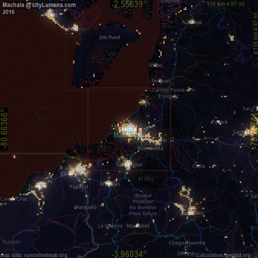
Analysis of Machala night lights 2016
Square area 10x10 km:
 18.18%
90-99
17.75%80-89
13.2%70-79
16.45%60-69
1.95%50-59
3.46%40-49
6.93%30-39
8.87%20-29
10.82%10-19
2.38%0-9
0%Square area 50x50 km:
1.04%90-99
0.98%80-89
2%70-79
2.14%60-69
0.32%50-59
0.37%40-49
1.07%30-39
1.54%20-29
3.02%10-19
7.77%0-9
79.75%Clear (daylight) street map image can be seen on geolist.org.
Map coordinates:
2° 33' 23" South, 80° 39' 49.2" West
3° 15' 31" South, 79° 57' 37.9" West
3° 57' 37.2" South, 79° 15' 26.7" West
Some cities around Machala sort by population:
• Pasaje
18.6 km =11.6 mi,  113°
113°
• Santa Rosa
21.1 km =13.1 mi,  179°
179°
• Huaquillas
38.5 km =23.9 mi,  231°
231°
• Piñas
56.3 km =35 mi,  146°
146°
• Zarumilla, PE
44.1 km =27.4 mi, 231°
• Baláo
41.9 km =26 mi,  22°
22°
• Aguas Verdes, PE
40.1 km =24.9 mi, 231°
• Puerto Bolívar
4.2 km =2.6 mi,  257°
257°
3654533 (p: 198,123)
Sources (retrieved 2019-11-25):
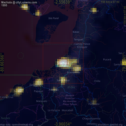
» NASA, Earths city lights 1995
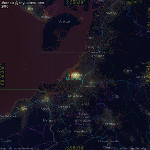
» NASA city lights 2003
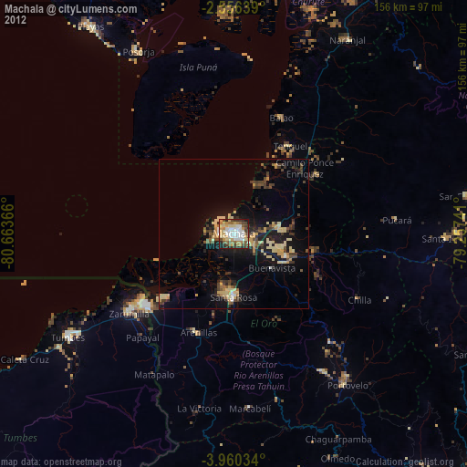
» Earth at Night: Flat Maps 2012, 2016