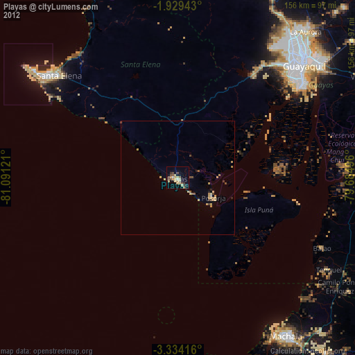
Playas night lights from space
Night Light of Playas (Guayas) from space (Ecuador) Src. Average luminocity for 10x10km area is 30.5325% and for 50x50km: 3.1177%.
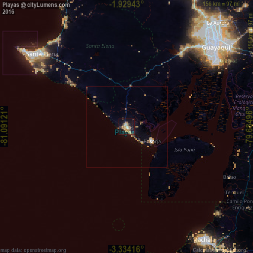
Analysis of Playas night lights 2016
Square area 10x10 km:
 2.16%
2.16%90-99
2.16%80-89
5.41%70-79
10.82%60-69
3.68%50-59
1.3%40-49
6.28%30-39
2.81%20-29
1.95%10-19
36.15%0-9
27.27%Square area 50x50 km:
0.19%90-99
0.12%80-89
0.48%70-79
0.97%60-69
0.28%50-59
0.29%40-49
0.46%30-39
0.42%20-29
0.49%10-19
2.09%0-9
94.21%Clear (daylight) street map image can be seen on geolist.org.
Map coordinates:
1° 55' 45.9" South, 81° 5' 28.4" West
2° 37' 55.2" South, 80° 23' 17.1" West
3° 20' 3" South, 79° 41' 5.9" West
Some cities around Playas sort by population:
• Guayaquil
73.9 km =45.9 mi,  49°
49°
• Eloy Alfaro
78 km =48.5 mi, 49°
• La Libertad
73 km =45.4 mi,  307°
307°
• Salinas
77.9 km =48.4 mi, 306°
• Santa Elena
69.1 km =42.9 mi, 310°
• Santa Lucía
65.9 km =40.9 mi,  40°
40°
• Baláo
70.9 km =44.1 mi,  115°
115°
• Puerto Bolívar
82.8 km =51.4 mi,  148°
148°
3653015 (p: 30,564)
Sources (retrieved 2019-11-25):
» Earth at Night: Flat Maps 2012, 2016