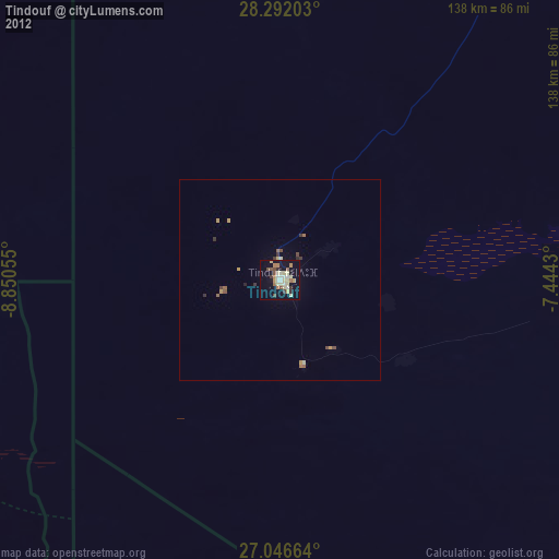
Tindouf night lights from space
Night Light of Tindouf from space (Algeria) Src. Average luminocity for 10x10km area is 33.9425% and for 50x50km: 2.3213%.
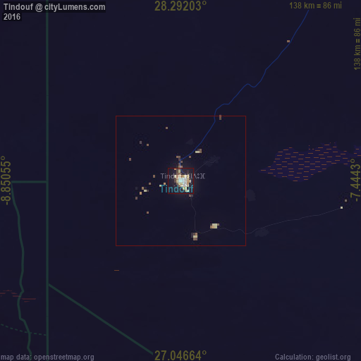
Analysis of Tindouf night lights 2016
Square area 10x10 km:
 4.96%
4.96%90-99
4.76%80-89
10.12%70-79
2.98%60-69
3.17%50-59
2.98%40-49
2.78%30-39
3.37%20-29
2.38%10-19
41.27%0-9
21.23%Square area 50x50 km:
0.19%90-99
0.18%80-89
0.64%70-79
0.17%60-69
0.16%50-59
0.31%40-49
0.49%30-39
0.38%20-29
0.25%10-19
1.96%0-9
95.26%Clear (daylight) street map image can be seen on geolist.org.
Map coordinates:
28° 17' 31.3" North, 8° 51' 2" West
27° 40' 16" North, 8° 8' 50.7" West
27° 2' 47.9" North, 7° 26' 39.5" West
Some cities around Tindouf sort by population:
• Guelmim, MA
237.4 km =147.5 mi,  308°
308°
• Taroudant, MA
319.2 km =198.3 mi,  347°
347°
• Oulad Teïma, MA
319.9 km =198.8 mi,  341°
341°
• Tan-Tan, MA
302.3 km =187.8 mi,  286°
286°
• Dakhla, MA
334 km =207.5 mi, 335°
• Tiznit, MA
273.2 km =169.8 mi,  325°
325°
• Sidi Ifni, MA
274.3 km =170.4 mi, 313°
• Zag, MA
119.3 km =74.1 mi, 289°
2476301 (p: 45,966)
Sources (retrieved 2019-11-25):
» Earth at Night: Flat Maps 2012, 2016