Tazoult-Lambese night lights from space
Night Light of Tazoult-Lambese (Batna) from space (Algeria) Src. Average luminocity for 10x10km area is 27.5385% and for 50x50km: 12.3482%.
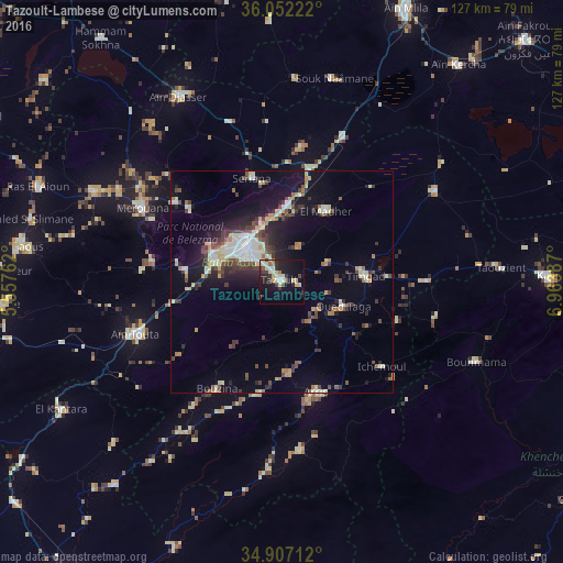
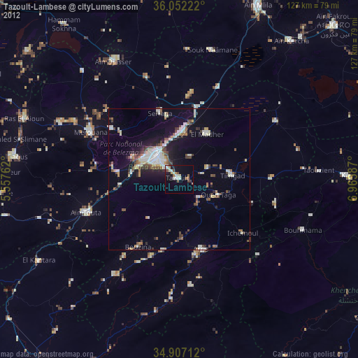
Analysis of Tazoult-Lambese night lights 2016
Square area 10x10 km:
 2.56%
2.56%90-99
5.49%80-89
6.59%70-79
2.01%60-69
1.83%50-59
2.93%40-49
1.1%30-39
6.78%20-29
5.68%10-19
25.82%0-9
39.19%Square area 50x50 km:
1.34%90-99
2.34%80-89
1.42%70-79
1.22%60-69
1.03%50-59
1.12%40-49
2.07%30-39
2.74%20-29
2.8%10-19
8.48%0-9
75.43%Clear (daylight) street map image can be seen on geolist.org.
Map coordinates:
36° 3' 8" North, 5° 33' 27.4" East
35° 28' 54.2" North, 6° 15' 38.7" East
34° 54' 25.6" North, 6° 57' 49.9" East
Some cities around Tazoult-Lambese sort by population:
• Batna
11.4 km =7.1 mi,  316°
316°
• Aïn Touta
34.7 km =21.6 mi,  250°
250°
• Telerghma
71.1 km =44.2 mi,  6°
6°
• Merouana
35.7 km =22.2 mi,  297°
297°
• Arris
26 km =16.2 mi,  162°
162°
• Râs el Aïoun
59.6 km =37 mi,  290°
290°
• Aïn Kercha
63 km =39.1 mi,  38°
38°
• Boumagueur
64.2 km =39.9 mi,  272°
272°
2477528 (p: 41,636)
Sources (retrieved 2019-11-25):
» Earth at Night: Flat Maps 2012, 2016