Batna night lights from space
Night Light of Batna from space (Algeria) Src. Average luminocity for 10x10km area is 73.4322% and for 50x50km: 13.76%.
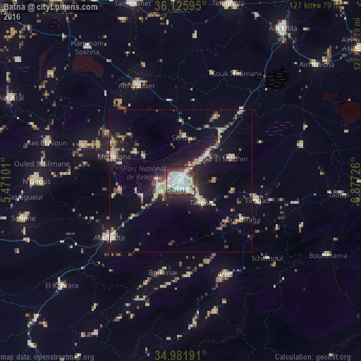
Analysis of Batna night lights 2016
Square area 10x10 km:
 20.51%
90-99
28.57%80-89
6.96%70-79
4.4%60-69
0.92%50-59
5.49%40-49
15.75%30-39
12.09%20-29
5.13%10-19
0.18%0-9
0%Square area 50x50 km:
1.47%90-99
2.39%80-89
1.69%70-79
1.58%60-69
1.07%50-59
1.29%40-49
2.18%30-39
3.04%20-29
3%10-19
10.44%0-9
71.84%Clear (daylight) street map image can be seen on geolist.org.
Map coordinates:
36° 7' 33.4" North, 5° 28' 15.6" East
35° 33' 21.5" North, 6° 10' 26.9" East
34° 58' 54.9" North, 6° 52' 38.1" East
Some cities around Batna sort by population:
• Aïn Touta
31.8 km =19.8 mi,  231°
231°
• Telerghma
64.4 km =40 mi,  14°
14°
• Merouana
25.1 km =15.6 mi,  289°
289°
• Tazoult-Lambese
11.4 km =7.1 mi,  136°
136°
• Arris
36.6 km =22.7 mi,  154°
154°
• Râs el Aïoun
49.6 km =30.8 mi, 285°
• Aïn Kercha
62.4 km =38.8 mi,  48°
48°
• Boumagueur
56.5 km =35.1 mi,  264°
264°
2505572 (p: 280,798)
Sources (retrieved 2019-11-25):
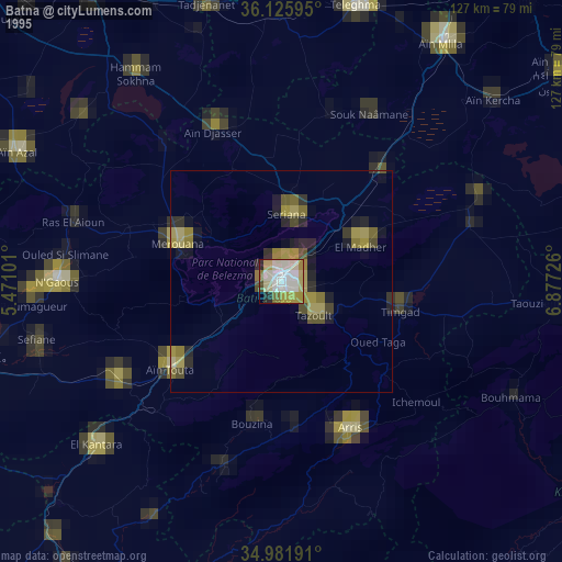
» NASA, Earths city lights 1995
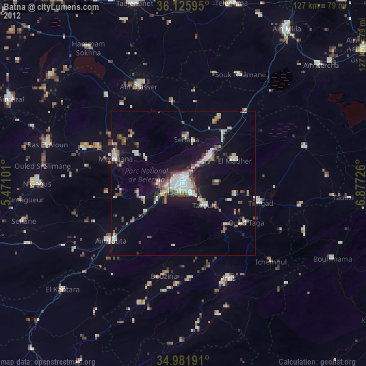
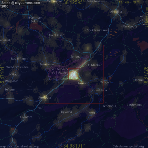
» NASA city lights 2003
» Earth at Night: Flat Maps 2012, 2016