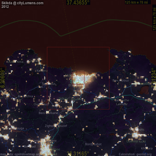
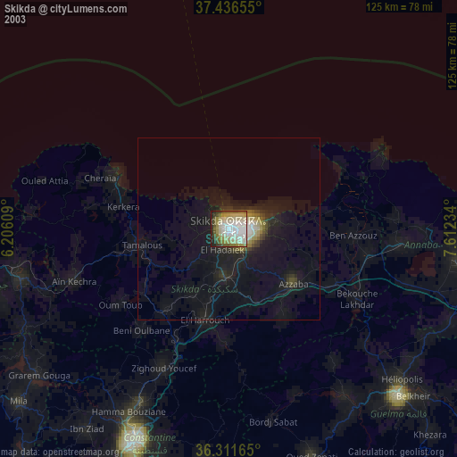
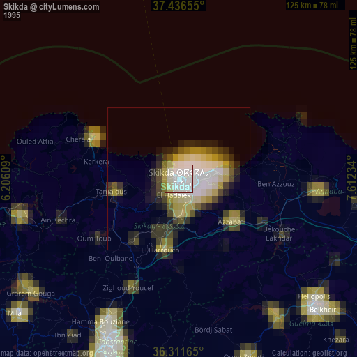
Skikda night lights from space
Night Light of Skikda from space (Algeria) Src. Average luminocity for 10x10km area is 59.9854% and for 50x50km: 10.9178%.

Analysis of Skikda night lights 2016
Square area 10x10 km:
 18.99%
90-99
16.4%80-89
4.87%70-79
7.95%60-69
3.08%50-59
5.68%40-49
3.57%30-39
6.49%20-29
14.45%10-19
16.56%0-9
1.95%Square area 50x50 km:
1.49%90-99
1.7%80-89
0.96%70-79
1.76%60-69
0.76%50-59
1.12%40-49
1.91%30-39
1.92%20-29
2.58%10-19
8.96%0-9
76.85%Clear (daylight) street map image can be seen on geolist.org.
Map coordinates:
37° 26' 11.6" North, 6° 12' 21.9" East
36° 52' 34.2" North, 6° 54' 33.2" East
36° 18' 41.9" North, 7° 36' 44.4" East
Some cities around Skikda sort by population:
• Constantine
62.6 km =38.9 mi,  204°
204°
• Azzaba
23.1 km =14.4 mi,  131°
131°
• Hamma Bouziane
58.7 km =36.5 mi,  208°
208°
• Karkira
29.4 km =18.3 mi,  281°
281°
• Héliopolis
63.1 km =39.2 mi, 131°
• Tamalous
24.3 km =15.1 mi,  259°
259°
• Didouche Mourad
53 km =32.9 mi, 207°
• Berrahal
48.6 km =30.2 mi,  95°
95°
2479536 (p: 162,702)
Sources (retrieved 2019-11-25):
» NASA, Earths city lights 1995
» NASA city lights 2003
» Earth at Night: Flat Maps 2012, 2016