Sidi Okba night lights from space
Night Light of Sidi Okba (Biskra) from space (Algeria) Src. Average luminocity for 10x10km area is 7.2839% and for 50x50km: 5.6296%.
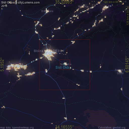

Analysis of Sidi Okba night lights 2016
Square area 10x10 km:
 0.73%
0.73%90-99
1.28%80-89
2.38%70-79
0.73%60-69
1.47%50-59
0%40-49
0%30-39
0.55%20-29
0.73%10-19
0.18%0-9
91.94%Square area 50x50 km:
0.81%90-99
1.1%80-89
1.35%70-79
0.4%60-69
0.31%50-59
0.5%40-49
0.48%30-39
0.82%20-29
1.36%10-19
3.43%0-9
89.45%Clear (daylight) street map image can be seen on geolist.org.
Map coordinates:
35° 19' 15.1" North, 5° 11' 42.7" East
34° 44' 42.4" North, 5° 53' 54" East
34° 9' 55.3" North, 6° 36' 5.2" East
Some cities around Sidi Okba sort by population:
• Biskra
19.5 km =12.1 mi,  306°
306°
• Barika
86.5 km =53.7 mi,  325°
325°
• Aïn Touta
70.2 km =43.6 mi,  0°
0°
• Tolga
47.6 km =29.6 mi,  266°
266°
• Tazoult-Lambese
88.3 km =54.9 mi,  21°
21°
• Arris
70.2 km =43.6 mi,  35°
35°
• Zeribet el Oued
56.4 km =35 mi,  97°
97°
• Oumache
20.7 km =12.9 mi,  253°
253°
2479916 (p: 34,985)
Sources (retrieved 2019-11-25):
» Earth at Night: Flat Maps 2012, 2016