Oumache night lights from space
Night Light of Oumache (Biskra) from space (Algeria) Src. Average luminocity for 10x10km area is 6.011% and for 50x50km: 7.5886%.
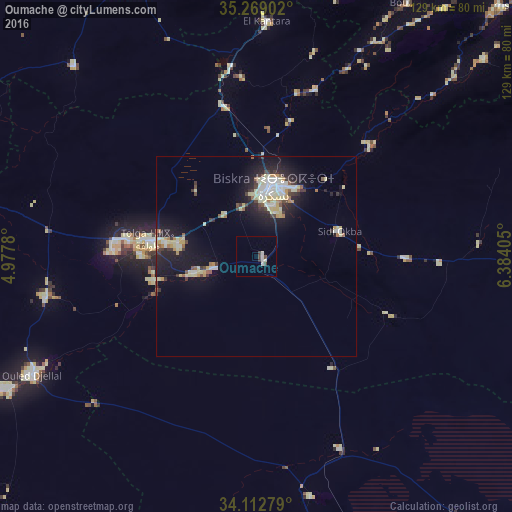
Analysis of Oumache night lights 2016
Square area 10x10 km:
 0.55%
0.55%90-99
2.75%80-89
0.37%70-79
0%60-69
0%50-59
0%40-49
2.01%30-39
1.47%20-29
0.18%10-19
0%0-9
92.67%Square area 50x50 km:
0.93%90-99
1.27%80-89
1.81%70-79
0.59%60-69
0.55%50-59
0.6%40-49
0.59%30-39
1.23%20-29
1.83%10-19
6.51%0-9
84.08%Clear (daylight) street map image can be seen on geolist.org.
Map coordinates:
35° 16' 8.5" North, 4° 58' 40.1" East
34° 41' 34.5" North, 5° 40' 51.3" East
34° 6' 46" North, 6° 23' 2.6" East
Some cities around Oumache sort by population:
• Biskra
18 km =11.2 mi,  13°
13°
• Barika
82.5 km =51.3 mi,  339°
339°
• Aïn Touta
78.6 km =48.8 mi, 14°
• Tolga
27.8 km =17.3 mi,  276°
276°
• Sidi Khaled
72 km =44.7 mi,  241°
241°
• Arris
87.4 km =54.3 mi,  43°
43°
• Sidi Okba
20.7 km =12.9 mi,  73°
73°
• Zeribet el Oued
75.9 km =47.2 mi,  90°
90°
2484738 (p: 10,424)
Sources (retrieved 2019-11-25):
» Earth at Night: Flat Maps 2012, 2016