Rouissat night lights from space
Night Light of Rouissat (Ouargla) from space (Algeria) Src. Average luminocity for 10x10km area is 60.1224% and for 50x50km: 7.6029%.
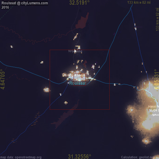
Analysis of Rouissat night lights 2016
Square area 10x10 km:
 22.9%
22.9%90-99
16.96%80-89
2.27%70-79
3.85%60-69
5.77%50-59
6.47%40-49
2.1%30-39
1.92%20-29
16.78%10-19
18.88%0-9
2.1%Square area 50x50 km:
1.82%90-99
1.53%80-89
0.38%70-79
0.42%60-69
0.61%50-59
0.92%40-49
0.86%30-39
1.02%20-29
2.81%10-19
5.03%0-9
84.6%Clear (daylight) street map image can be seen on geolist.org.
Map coordinates:
32° 31' 8.8" North, 4° 38' 49.4" East
31° 55' 27.4" North, 5° 21' 0.6" East
31° 19' 32" North, 6° 3' 11.9" East
Some cities around Rouissat sort by population:
• Ouargla
3.7 km =2.3 mi,  319°
319°
• Hassi Messaoud
73.5 km =45.7 mi,  111°
111°
• Metlili Chaamba
166.1 km =103.2 mi,  283°
283°
• Touggourt
147.1 km =91.4 mi,  26°
26°
• Tebesbest
149.3 km =92.8 mi, 27°
• El Hadjira
78.1 km =48.5 mi,  11°
11°
• Megarine
157 km =97.6 mi, 26°
• Taïbet
161.7 km =100.5 mi,  37°
37°
2482886 (p: 80,784)
Sources (retrieved 2019-11-25):
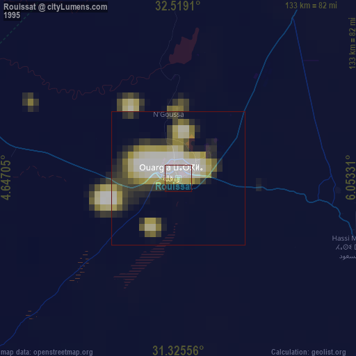
» NASA, Earths city lights 1995
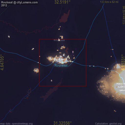
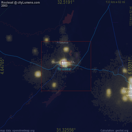
» NASA city lights 2003
» Earth at Night: Flat Maps 2012, 2016