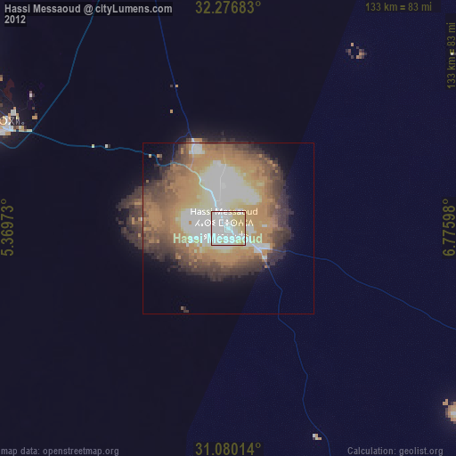
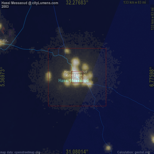
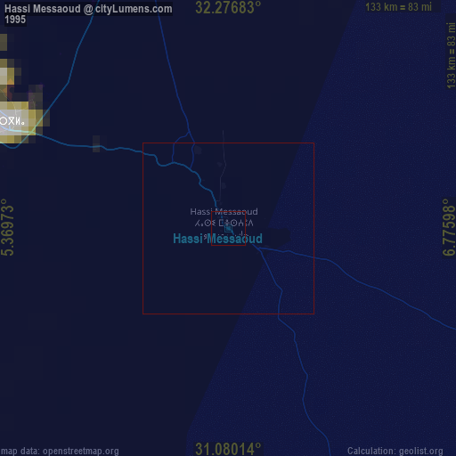
Hassi Messaoud night lights from space
Night Light of Hassi Messaoud (Ouargla) from space (Algeria) Src. Average luminocity for 10x10km area is 93.7857% and for 50x50km: 46.7277%.
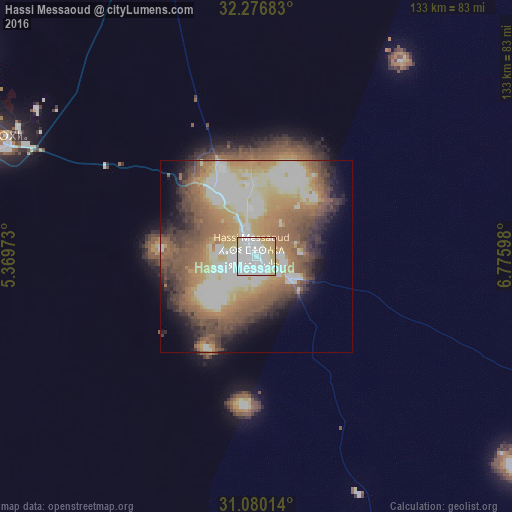
Analysis of Hassi Messaoud night lights 2016
Square area 10x10 km:
 51.83%
90-99
21.25%80-89
11.9%70-79
12.82%60-69
2.2%50-59
0%40-49
0%30-39
0%20-29
0%10-19
0%0-9
0%Square area 50x50 km:
8.97%90-99
9.12%80-89
5.76%70-79
7.54%60-69
8.45%50-59
10.33%40-49
6.89%30-39
5.66%20-29
4.49%10-19
5.64%0-9
27.15%Clear (daylight) street map image can be seen on geolist.org.
Map coordinates:
32° 16' 36.6" North, 5° 22' 11" East
31° 40' 49.5" North, 6° 4' 22.3" East
31° 4' 48.5" North, 6° 46' 33.5" East
Some cities around Hassi Messaoud sort by population:
• Ouargla
76.7 km =47.7 mi,  292°
292°
• Rouissat
73.5 km =45.7 mi, 291°
• Touggourt
158.4 km =98.4 mi,  359°
359°
• Tebesbest
159.7 km =99.2 mi,  0°
0°
• El Hadjira
116.4 km =72.3 mi,  333°
333°
• Megarine
168.1 km =104.5 mi, 0°
• Robbah
194.4 km =120.8 mi,  23°
23°
• Taïbet
159 km =98.8 mi,  10°
10°
2494029 (p: 53,000)
Sources (retrieved 2019-11-25):
» NASA, Earths city lights 1995
» NASA city lights 2003
» Earth at Night: Flat Maps 2012, 2016