Metlili Chaamba night lights from space
Night Light of Metlili Chaamba (Ghardaia) from space (Algeria) Src. Average luminocity for 10x10km area is 31.7216% and for 50x50km: 5.0903%.
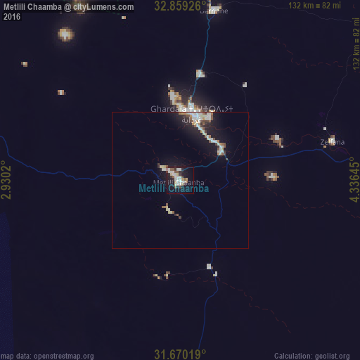
Analysis of Metlili Chaamba night lights 2016
Square area 10x10 km:
 6.78%
6.78%90-99
8.61%80-89
3.66%70-79
1.47%60-69
0%50-59
5.49%40-49
2.56%30-39
2.01%20-29
5.68%10-19
31.68%0-9
32.05%Square area 50x50 km:
0.81%90-99
1.15%80-89
0.64%70-79
0.26%60-69
0.28%50-59
0.66%40-49
0.54%30-39
0.36%20-29
1.12%10-19
4.99%0-9
89.19%Clear (daylight) street map image can be seen on geolist.org.
Map coordinates:
32° 51' 33.3" North, 2° 55' 48.7" East
32° 16' 0" North, 3° 37' 60" East
31° 40' 12.7" North, 4° 20' 11.2" East
Some cities around Metlili Chaamba sort by population:
• Ouargla
163.2 km =101.4 mi,  102°
102°
• Laghouat
184.9 km =114.9 mi,  337°
337°
• Messaad
210.2 km =130.6 mi,  356°
356°
• Ghardaïa
25.2 km =15.7 mi,  8°
8°
• Rouissat
166.1 km =103.2 mi, 103°
• Berriane
63.5 km =39.5 mi, 11°
• El Hadjira
180.5 km =112.2 mi,  77°
77°
• ’Aïn el Bell
234.1 km =145.5 mi,  350°
350°
2487620 (p: 50,117)
Sources (retrieved 2019-11-25):
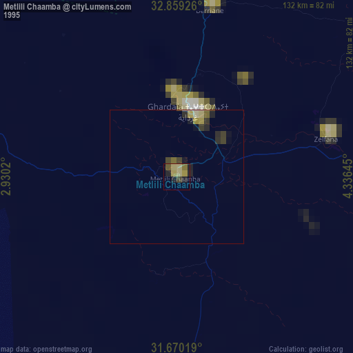
» NASA, Earths city lights 1995
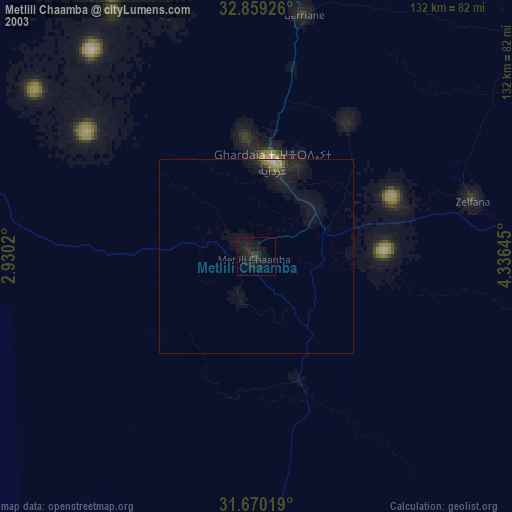
» NASA city lights 2003
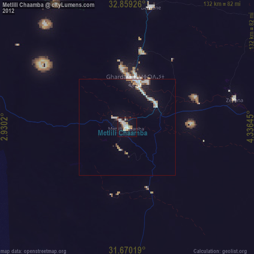
» Earth at Night: Flat Maps 2012, 2016