Rouiba night lights from space
Night Light of Rouiba (Algiers) from space (Algeria) Src. Average luminocity for 10x10km area is 91.6556% and for 50x50km: 37.8969%.
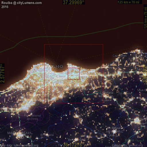

Analysis of Rouiba night lights 2016
Square area 10x10 km:
 32.69%
90-99
31.12%80-89
17.13%70-79
18.36%60-69
0.7%50-59
0%40-49
0%30-39
0%20-29
0%10-19
0%0-9
0%Square area 50x50 km:
9.21%90-99
8.08%80-89
4.46%70-79
6.59%60-69
6.24%50-59
3.04%40-49
3.34%30-39
4.22%20-29
7.12%10-19
8.93%0-9
38.76%Clear (daylight) street map image can be seen on geolist.org.
Map coordinates:
37° 17' 58.9" North, 2° 34' 39.6" East
36° 44' 17.8" North, 3° 16' 50.8" East
36° 10' 21.9" North, 3° 59' 2.1" East
Some cities around Rouiba sort by population:
• Bab Ezzouar
8.8 km =5.5 mi,  261°
261°
• Bordj el Kiffan
8 km =5 mi,  278°
278°
• Reghaïa
5.3 km =3.3 mi,  92°
92°
• Khemis el Khechna
10.8 km =6.7 mi,  155°
155°
• Boudouaou
11.6 km =7.2 mi,  96°
96°
• Dar el Beïda
6.7 km =4.2 mi,  245°
245°
• Aïn Taya
6.1 km =3.8 mi,  5°
5°
• Ouled Moussa
9.7 km =6 mi,  128°
128°
2482908 (p: 20,742)
Sources (retrieved 2019-11-25):
» Earth at Night: Flat Maps 2012, 2016