Aïn Taya night lights from space
Night Light of Aïn Taya (Algiers) from space (Algeria) Src. Average luminocity for 10x10km area is 63.6171% and for 50x50km: 34.7488%.
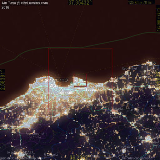
Analysis of Aïn Taya night lights 2016
Square area 10x10 km:
 22.03%
90-99
20.1%80-89
6.12%70-79
8.74%60-69
2.45%50-59
0.35%40-49
1.57%30-39
5.94%20-29
13.99%10-19
15.73%0-9
2.97%Square area 50x50 km:
8.89%90-99
7.58%80-89
4.09%70-79
6.23%60-69
5.51%50-59
2.76%40-49
2.57%30-39
3.54%20-29
6.65%10-19
7.67%0-9
44.52%Clear (daylight) street map image can be seen on geolist.org.
Map coordinates:
37° 21' 15.6" North, 2° 35' 1.7" East
36° 47' 36" North, 3° 17' 13" East
36° 13' 41.5" North, 3° 59' 24.2" East
Some cities around Aïn Taya sort by population:
• Bab Ezzouar
11.9 km =7.4 mi,  231°
231°
• Bordj el Kiffan
9.8 km =6.1 mi,  239°
239°
• Reghaïa
8 km =5 mi,  143°
143°
• Khemis el Khechna
16.4 km =10.2 mi,  166°
166°
• Boudouaou
13.2 km =8.2 mi,  123°
123°
• Dar el Beïda
11.1 km =6.9 mi,  216°
216°
• Rouiba
6.1 km =3.8 mi,  185°
185°
• Ouled Moussa
14.1 km =8.8 mi,  149°
149°
2507912 (p: 21,815)
Sources (retrieved 2019-11-25):
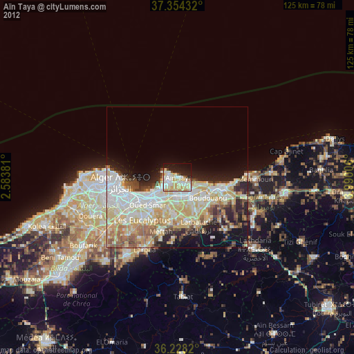
» Earth at Night: Flat Maps 2012, 2016