Boudouaou night lights from space
Night Light of Boudouaou (Boumerdes) from space (Algeria) Src. Average luminocity for 10x10km area is 79.9249% and for 50x50km: 31.5031%.
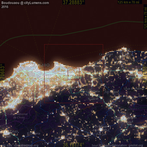
Analysis of Boudouaou night lights 2016
Square area 10x10 km:
 19.41%
90-99
24.36%80-89
6.96%70-79
18.32%60-69
16.3%50-59
6.04%40-49
5.49%30-39
3.11%20-29
0%10-19
0%0-9
0%Square area 50x50 km:
5.32%90-99
6%80-89
3.61%70-79
5.94%60-69
5.52%50-59
2.72%40-49
2.9%30-39
5.08%20-29
8.89%10-19
13.08%0-9
40.94%Clear (daylight) street map image can be seen on geolist.org.
Map coordinates:
37° 17' 19.8" North, 2° 42' 24.6" East
36° 43' 38.5" North, 3° 24' 35.8" East
36° 9' 42.3" North, 4° 6' 47.1" East
Some cities around Boudouaou sort by population:
• Boumerdas
7.4 km =4.6 mi,  54°
54°
• Reghaïa
6.3 km =3.9 mi,  278°
278°
• Khemis el Khechna
11.1 km =6.9 mi,  219°
219°
• Aïn Taya
13.2 km =8.2 mi,  303°
303°
• Rouiba
11.6 km =7.2 mi, 276°
• Arbatache
10.5 km =6.5 mi,  199°
199°
• Thenia
13.1 km =8.1 mi,  90°
90°
• Ouled Moussa
6.2 km =3.9 mi, 218°
2503229 (p: 45,153)
Sources (retrieved 2019-11-25):
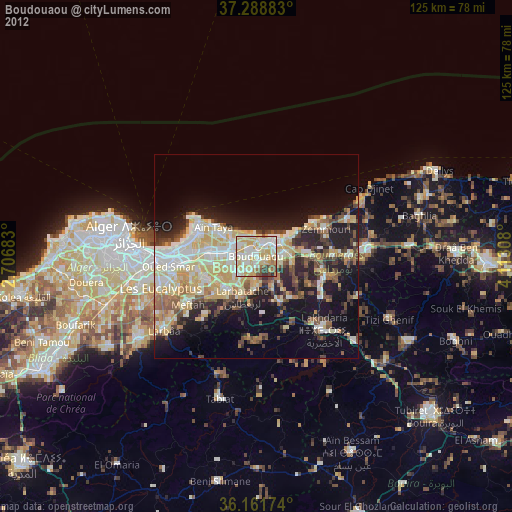
» Earth at Night: Flat Maps 2012, 2016