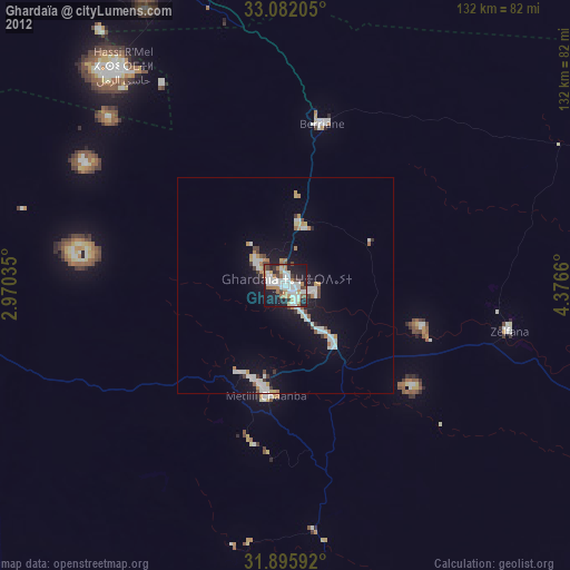
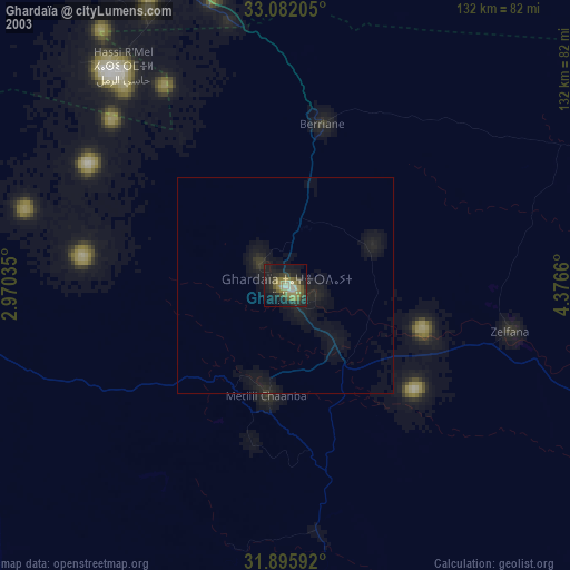
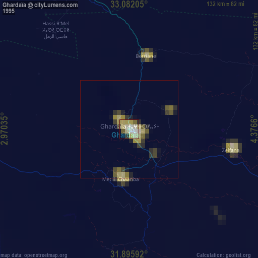
Ghardaïa night lights from space
Night Light of Ghardaïa (Ghardaia) from space (Algeria) Src. Average luminocity for 10x10km area is 57.881% and for 50x50km: 7.0816%.
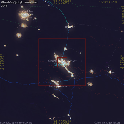
Analysis of Ghardaïa night lights 2016
Square area 10x10 km:
 13.55%
90-99
17.77%80-89
5.13%70-79
5.49%60-69
5.13%50-59
4.95%40-49
6.78%30-39
7.88%20-29
20.33%10-19
12.27%0-9
0.73%Square area 50x50 km:
1.21%90-99
1.77%80-89
0.61%70-79
0.52%60-69
0.42%50-59
0.72%40-49
0.66%30-39
0.8%20-29
1.91%10-19
6.26%0-9
85.13%Clear (daylight) street map image can be seen on geolist.org.
Map coordinates:
33° 4' 55.4" North, 2° 58' 13.3" East
32° 29' 27.4" North, 3° 40' 24.5" East
31° 53' 45.3" North, 4° 22' 35.8" East
Some cities around Ghardaïa sort by population:
• Ouargla
166.6 km =103.5 mi,  111°
111°
• Laghouat
163.9 km =101.8 mi,  332°
332°
• Messaad
185.6 km =115.3 mi,  355°
355°
• Rouissat
169.9 km =105.6 mi, 111°
• Metlili Chaamba
25.2 km =15.7 mi,  188°
188°
• Berriane
38.3 km =23.8 mi,  13°
13°
• El Hadjira
172.9 km =107.4 mi,  85°
85°
• ’Aïn el Bell
210.2 km =130.6 mi,  348°
348°
2496049 (p: 93,423)
Sources (retrieved 2019-11-25):
» NASA, Earths city lights 1995
» NASA city lights 2003
» Earth at Night: Flat Maps 2012, 2016