Ksar el Boukhari night lights from space
Night Light of Ksar el Boukhari (Medea) from space (Algeria) Src. Average luminocity for 10x10km area is 27.5604% and for 50x50km: 2.5863%.
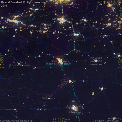
Analysis of Ksar el Boukhari night lights 2016
Square area 10x10 km:
 2.2%
2.2%90-99
6.96%80-89
6.23%70-79
5.13%60-69
1.83%50-59
1.83%40-49
0.55%30-39
1.83%20-29
1.28%10-19
31.32%0-9
40.84%Square area 50x50 km:
0.08%90-99
0.5%80-89
0.59%70-79
0.41%60-69
0.14%50-59
0.27%40-49
0.34%30-39
0.31%20-29
0.24%10-19
1.33%0-9
95.78%Clear (daylight) street map image can be seen on geolist.org.
Map coordinates:
36° 27' 23.3" North, 2° 2' 45.3" East
35° 53' 20" North, 2° 44' 56.6" East
35° 19' 2" North, 3° 27' 7.8" East
Some cities around Ksar el Boukhari sort by population:
• Médéa
41.7 km =25.9 mi,  0°
0°
• Aïn Oussera
50.7 km =31.5 mi,  163°
163°
• Berrouaghia
31 km =19.3 mi,  27°
27°
• Khemis Miliana
63 km =39.1 mi,  311°
311°
• Birine
51.4 km =31.9 mi,  123°
123°
• Boû Arfa
64.1 km =39.8 mi,  5°
5°
• Chiffa
63.8 km =39.6 mi,  359°
359°
• ’Aïn Boucif
36.9 km =22.9 mi,  89°
89°
2491323 (p: 77,166)
Sources (retrieved 2019-11-25):
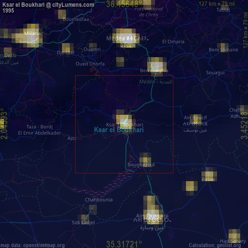
» NASA, Earths city lights 1995
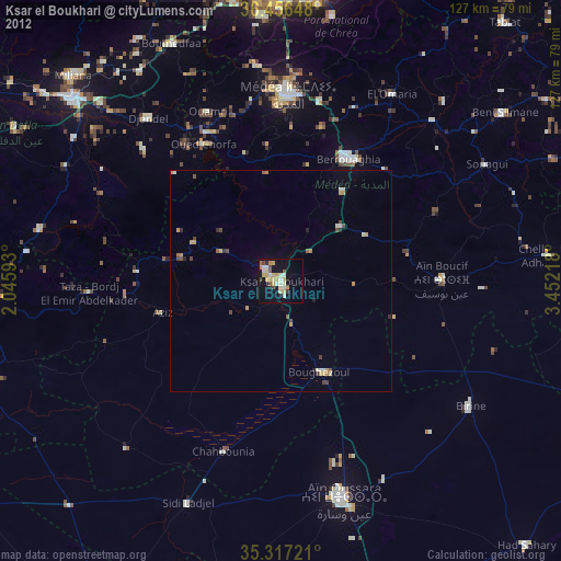
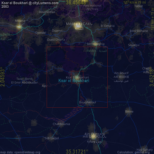
» NASA city lights 2003
» Earth at Night: Flat Maps 2012, 2016