Khemis Miliana night lights from space
Night Light of Khemis Miliana (Aïn Defla) from space (Algeria) Src. Average luminocity for 10x10km area is 35.3776% and for 50x50km: 7.1613%.
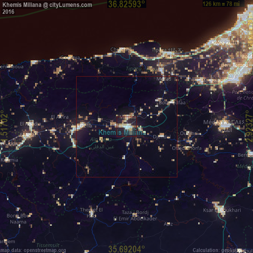
Analysis of Khemis Miliana night lights 2016
Square area 10x10 km:
 2.62%
2.62%90-99
6.64%80-89
8.92%70-79
3.15%60-69
2.62%50-59
2.45%40-49
3.5%30-39
7.34%20-29
11.19%10-19
46.68%0-9
4.9%Square area 50x50 km:
0.46%90-99
0.82%80-89
1.17%70-79
0.68%60-69
1.26%50-59
0.42%40-49
0.84%30-39
1.35%20-29
1.4%10-19
5.95%0-9
85.64%Clear (daylight) street map image can be seen on geolist.org.
Map coordinates:
36° 49' 33.3" North, 1° 31' 1.3" East
36° 15' 39.7" North, 2° 13' 12.5" East
35° 41' 31.3" North, 2° 55' 23.8" East
Some cities around Khemis Miliana sort by population:
• Médéa
47.9 km =29.8 mi,  89°
89°
• Aïn Defla
22.6 km =14 mi,  270°
270°
• El Affroun
43.1 km =26.8 mi,  57°
57°
• Mouzaïa
47.9 km =29.8 mi, 61°
• El Abadia
47.9 km =29.8 mi, 271°
• Theniet el Had
46.7 km =29 mi,  201°
201°
• Hadjout
32.9 km =20.4 mi,  31°
31°
• Tipasa
41.8 km =26 mi, 29°
2491911 (p: 75,865)
Sources (retrieved 2019-11-25):
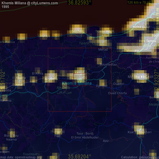
» NASA, Earths city lights 1995
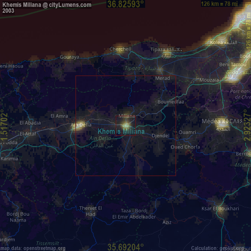
» NASA city lights 2003
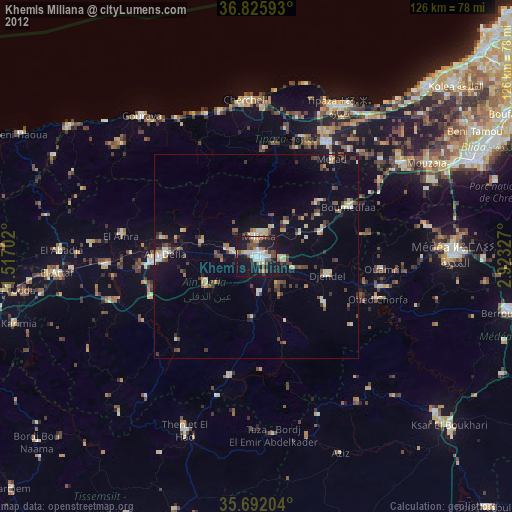
» Earth at Night: Flat Maps 2012, 2016