Chiffa night lights from space
Night Light of Chiffa (Blida) from space (Algeria) Src. Average luminocity for 10x10km area is 52.0037% and for 50x50km: 28.005%.
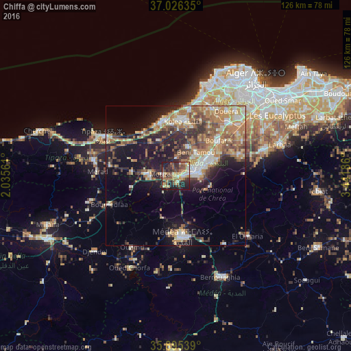
Analysis of Chiffa night lights 2016
Square area 10x10 km:
100  4.4%
4.4%
90-99 7.14%
80-89 8.06%
70-79 9.52%
60-69 13.92%
50-59 5.86%
40-49 10.26%
30-39 14.29%
20-29 15.2%
10-19 11.36%
0-9 0%
4.4%90-99
7.14%80-89
8.06%70-79
9.52%60-69
13.92%50-59
5.86%40-49
10.26%30-39
14.29%20-29
15.2%10-19
11.36%0-9
0%Square area 50x50 km:
100 3.11%
90-99 4.58%
80-89 3.5%
70-79 4.25%
60-69 7.07%
50-59 3.59%
40-49 3.7%
30-39 5.06%
20-29 6.51%
10-19 14.67%
0-9 43.95%
3.11%90-99
4.58%80-89
3.5%70-79
4.25%60-69
7.07%50-59
3.59%40-49
3.7%30-39
5.06%20-29
6.51%10-19
14.67%0-9
43.95%Clear (daylight) street map image can be seen on geolist.org.
Map coordinates:
37° 1' 34.9" North, 2° 2' 8.2" East
36° 27' 46.5" North, 2° 44' 19.4" East
35° 53' 43.4" North, 3° 26' 30.7" East
Some cities around Chiffa sort by population:
• Blida
8 km =5 mi,  84°
84°
• Beni Mered
12.9 km =8 mi,  58°
58°
• Boû Arfa
6.8 km =4.2 mi,  89°
89°
• El Affroun
10.2 km =6.3 mi,  274°
274°
• Souma
16.1 km =10 mi,  67°
67°
• Mouzaïa
4.4 km =2.7 mi,  275°
275°
• Kolea
19.7 km =12.2 mi,  7°
7°
• Oued el Alleug
11.3 km =7 mi,  24°
24°
2501323 (p: 23,218)
Sources (retrieved 2019-11-25):
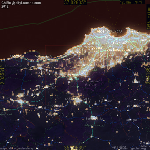
» Earth at Night: Flat Maps 2012, 2016