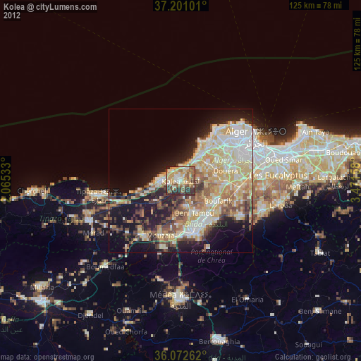
Kolea night lights from space
Night Light of Kolea (Tipaza) from space (Algeria) Src. Average luminocity for 10x10km area is 64.7821% and for 50x50km: 36.8113%.
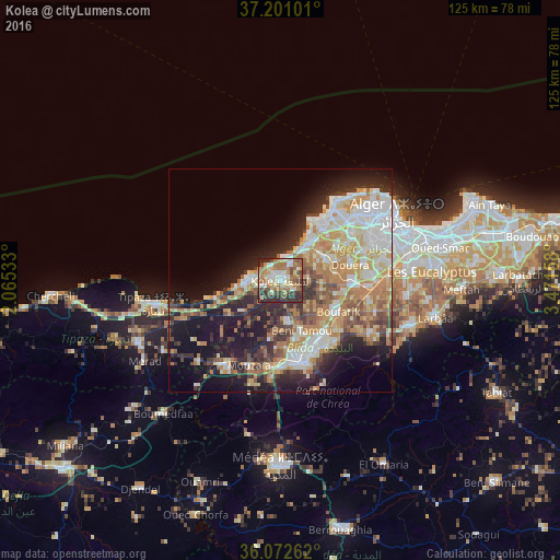
Analysis of Kolea night lights 2016
Square area 10x10 km:
 9.89%
9.89%90-99
12.09%80-89
10.62%70-79
6.59%60-69
23.26%50-59
6.96%40-49
10.26%30-39
10.99%20-29
9.34%10-19
0%0-9
0%Square area 50x50 km:
6.6%90-99
7.46%80-89
5.08%70-79
5.75%60-69
7.3%50-59
3.59%40-49
3.88%30-39
5%20-29
7.63%10-19
14.61%0-9
33.1%Clear (daylight) street map image can be seen on geolist.org.
Map coordinates:
37° 12' 3.6" North, 2° 3' 55.2" East
36° 38' 20" North, 2° 46' 6.4" East
36° 4' 21.4" North, 3° 28' 17.7" East
Some cities around Kolea sort by population:
• Blida
19.5 km =12.1 mi,  164°
164°
• Beni Mered
15.2 km =9.4 mi,  147°
147°
• Boufarik
14.7 km =9.1 mi,  119°
119°
• Souma
18.1 km =11.2 mi,  137°
137°
• Douera
16.1 km =10 mi,  77°
77°
• Bou Ismaïl
7 km =4.3 mi,  273°
273°
• Oued el Alleug
9.5 km =5.9 mi,  168°
168°
• Zeralda
10.4 km =6.5 mi,  39°
39°
2491578 (p: 31,816)
Sources (retrieved 2019-11-25):
» Earth at Night: Flat Maps 2012, 2016