Bou Ismaïl night lights from space
Night Light of Bou Ismaïl (Tipaza) from space (Algeria) Src. Average luminocity for 10x10km area is 49.0348% and for 50x50km: 29.944%.
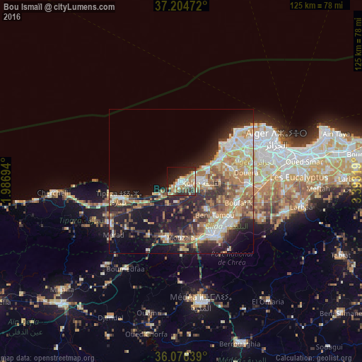
Analysis of Bou Ismaïl night lights 2016
Square area 10x10 km:
 6.23%
6.23%90-99
9.16%80-89
8.61%70-79
6.41%60-69
12.45%50-59
4.4%40-49
4.76%30-39
7.51%20-29
15.75%10-19
17.95%0-9
6.78%Square area 50x50 km:
4.28%90-99
5.44%80-89
4%70-79
4.66%60-69
6.36%50-59
3.14%40-49
3.47%30-39
5.01%20-29
8%10-19
14.73%0-9
40.9%Clear (daylight) street map image can be seen on geolist.org.
Map coordinates:
37° 12' 17" North, 1° 59' 13" East
36° 38' 33.4" North, 2° 41' 24.3" East
36° 4' 35" North, 3° 23' 35.5" East
Some cities around Bou Ismaïl sort by population:
• Beni Mered
20.2 km =12.6 mi,  130°
130°
• Boufarik
21.2 km =13.2 mi,  111°
111°
• El Affroun
20 km =12.4 mi,  196°
196°
• Mouzaïa
19.5 km =12.1 mi,  180°
180°
• Kolea
7 km =4.3 mi,  93°
93°
• Chiffa
20.4 km =12.7 mi,  167°
167°
• Oued el Alleug
13.2 km =8.2 mi,  137°
137°
• Zeralda
15.6 km =9.7 mi,  60°
60°
2502939 (p: 22,411)
Sources (retrieved 2019-11-25):
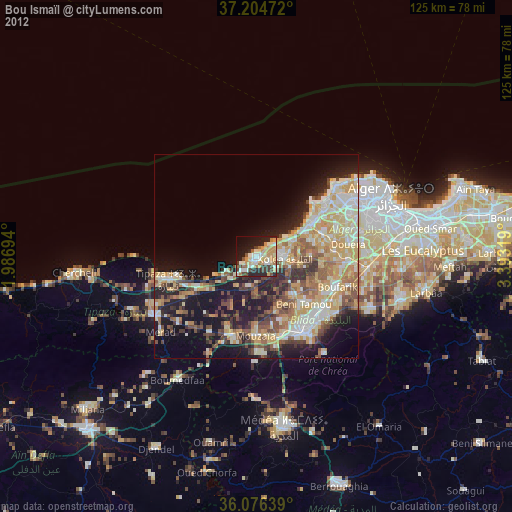
» Earth at Night: Flat Maps 2012, 2016