Draa el Mizan night lights from space
Night Light of Draa el Mizan (Bouira) from space (Algeria) Src. Average luminocity for 10x10km area is 22.8755% and for 50x50km: 19.0295%.
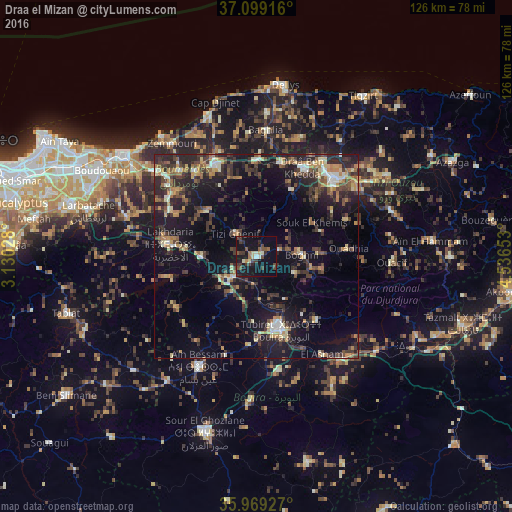
Analysis of Draa el Mizan night lights 2016
Square area 10x10 km:
 1.1%
1.1%90-99
2.38%80-89
2.38%70-79
1.1%60-69
2.56%50-59
3.3%40-49
6.59%30-39
7.88%20-29
3.48%10-19
35.71%0-9
33.52%Square area 50x50 km:
0.99%90-99
2.16%80-89
2.1%70-79
2.18%60-69
2.8%50-59
2.39%40-49
3.42%30-39
5.94%20-29
6.8%10-19
16.49%0-9
54.72%Clear (daylight) street map image can be seen on geolist.org.
Map coordinates:
37° 5' 57" North, 3° 7' 49" East
36° 32' 10.6" North, 3° 50' 0.2" East
35° 58' 9.4" North, 4° 32' 11.5" East
Some cities around Draa el Mizan sort by population:
• Lakhdaria
21.7 km =13.5 mi,  278°
278°
• Boghni
10.7 km =6.6 mi,  86°
86°
• Bouïra
19 km =11.8 mi,  161°
161°
• Tizi Gheniff
7.8 km =4.8 mi,  317°
317°
• Tirmitine
18.6 km =11.6 mi,  45°
45°
• Tizi-n-Tleta
20 km =12.4 mi, 87°
• Chabet el Ameur
16.7 km =10.4 mi,  312°
312°
• Naciria
23.3 km =14.5 mi,  359°
359°
2499104 (p: 41,263)
Sources (retrieved 2019-11-25):
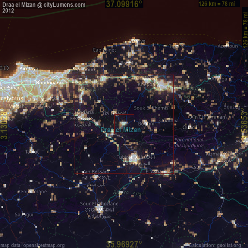
» Earth at Night: Flat Maps 2012, 2016