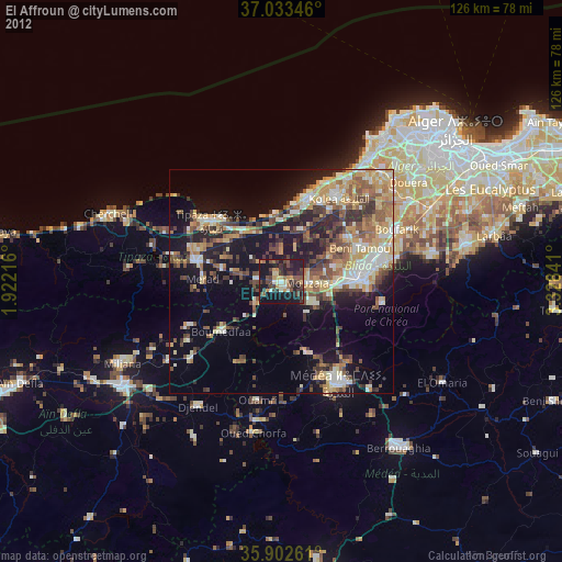
El Affroun night lights from space
Night Light of El Affroun (Tipaza) from space (Algeria) Src. Average luminocity for 10x10km area is 28.8608% and for 50x50km: 25.417%.
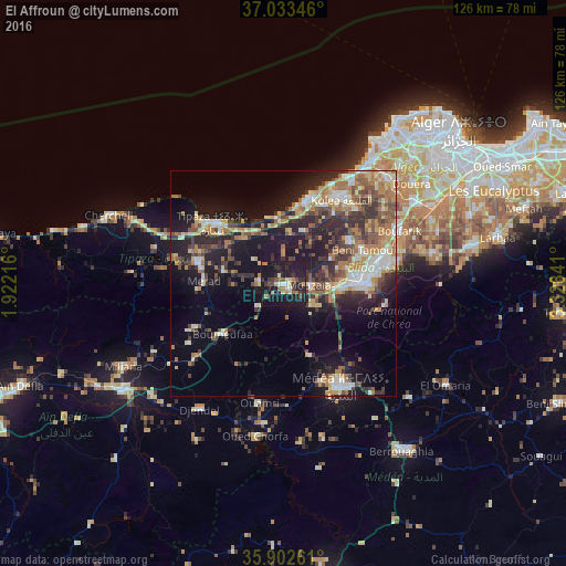
Analysis of El Affroun night lights 2016
Square area 10x10 km:
 0.92%
0.92%90-99
4.03%80-89
2.75%70-79
3.3%60-69
4.58%50-59
3.11%40-49
2.75%30-39
7.88%20-29
10.62%10-19
55.49%0-9
4.58%Square area 50x50 km:
2.76%90-99
3.93%80-89
3.05%70-79
2.97%60-69
5.84%50-59
3.14%40-49
3.58%30-39
5.37%20-29
7.33%10-19
16.24%0-9
45.77%Clear (daylight) street map image can be seen on geolist.org.
Map coordinates:
37° 2' 0.5" North, 1° 55' 19.8" East
36° 28' 12.4" North, 2° 37' 31" East
35° 54' 9.4" North, 3° 19' 42.3" East
Some cities around El Affroun sort by population:
• Blida
18.1 km =11.2 mi,  90°
90°
• Boû Arfa
17 km =10.6 mi, 92°
• Mouzaïa
5.8 km =3.6 mi, 93°
• Hadjout
19.5 km =12.1 mi,  284°
284°
• Tipasa
20.7 km =12.9 mi,  309°
309°
• Chiffa
10.2 km =6.3 mi, 94°
• Bou Ismaïl
20 km =12.4 mi,  16°
16°
• Oued el Alleug
17.5 km =10.9 mi,  57°
57°
2498752 (p: 42,627)
Sources (retrieved 2019-11-25):
» Earth at Night: Flat Maps 2012, 2016