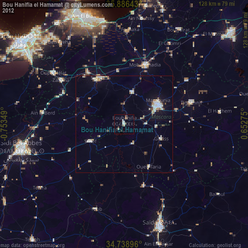
Bou Hanifia el Hamamat night lights from space
Night Light of Bou Hanifia el Hamamat (Mascara) from space (Algeria) Src. Average luminocity for 10x10km area is 5.9982% and for 50x50km: 4.9511%.
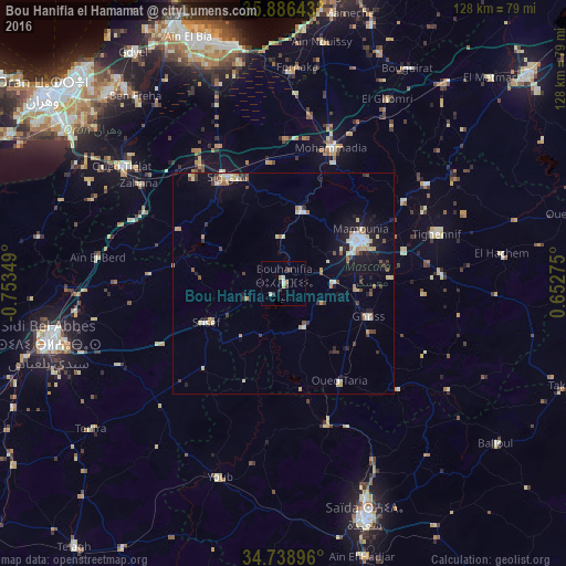
Analysis of Bou Hanifia el Hamamat night lights 2016
Square area 10x10 km:
 0.18%
0.18%90-99
1.23%80-89
1.41%70-79
0.71%60-69
0.53%50-59
0.18%40-49
0.35%30-39
2.29%20-29
1.59%10-19
0%0-9
91.53%Square area 50x50 km:
0.5%90-99
0.68%80-89
0.85%70-79
0.6%60-69
0.67%50-59
0.28%40-49
0.56%30-39
0.84%20-29
0.74%10-19
3.3%0-9
90.96%Clear (daylight) street map image can be seen on geolist.org.
Map coordinates:
35° 53' 11.1" North, 0° 45' 12.6" West
35° 18' 53" North, 0° 3' 1.3" West
34° 44' 20.3" North, 0° 39' 9.9" East
Some cities around Bou Hanifia el Hamamat sort by population:
• Sidi Bel Abbès
54.5 km =33.9 mi,  255°
255°
• Mascara
19.5 km =12.1 mi,  62°
62°
• Saïda
56.9 km =35.4 mi,  161°
161°
• Sig
27.1 km =16.8 mi,  331°
331°
• Aïn el Bya
59 km =36.7 mi,  337°
337°
• Sidi ech Chahmi
57.3 km =35.6 mi,  311°
311°
• Sfizef
19.7 km =12.2 mi,  243°
243°
• ’Aïn el Berd
42.3 km =26.3 mi,  277°
277°
2503033 (p: 27,576)
Sources (retrieved 2019-11-25):
» Earth at Night: Flat Maps 2012, 2016