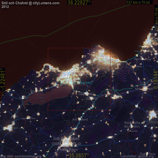
Sidi ech Chahmi night lights from space
Night Light of Sidi ech Chahmi (Oran) from space (Algeria) Src. Average luminocity for 10x10km area is 52.3252% and for 50x50km: 23.4328%.
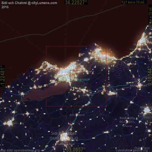
Analysis of Sidi ech Chahmi night lights 2016
Square area 10x10 km:
 5.07%
5.07%90-99
7.52%80-89
7.69%70-79
11.36%60-69
15.21%50-59
7.17%40-49
8.39%30-39
7.87%20-29
11.71%10-19
13.29%0-9
4.72%Square area 50x50 km:
4.12%90-99
3.96%80-89
2.91%70-79
2.8%60-69
3.88%50-59
2.35%40-49
3.03%30-39
4.06%20-29
6.18%10-19
13.24%0-9
53.47%Clear (daylight) street map image can be seen on geolist.org.
Map coordinates:
36° 13' 41.8" North, 1° 13' 29.3" West
35° 39' 32.5" North, 0° 31' 18" West
35° 5' 8.5" North, 0° 10' 53.2" East
Some cities around Sidi ech Chahmi sort by population:
• Oran
11.2 km =7 mi,  293°
293°
• Es Senia
9.3 km =5.8 mi,  262°
262°
• Bir el Djir
7.1 km =4.4 mi,  342°
342°
• Sig
33 km =20.5 mi,  116°
116°
• ’Aïn el Turk
24.3 km =15.1 mi, 292°
• Aïn el Bya
25.6 km =15.9 mi,  50°
50°
• Mers el Kebir
18.5 km =11.5 mi, 294°
• ’Aïn el Berd
32.8 km =20.4 mi,  178°
178°
2480618 (p: 35,512)
Sources (retrieved 2019-11-25):
» Earth at Night: Flat Maps 2012, 2016