Villa González night lights from space
Night Light of Villa González (Santiago) from space (Dominican Republic) Src. Average luminocity for 10x10km area is 31.2955% and for 50x50km: 15.1399%.
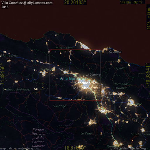
Analysis of Villa González night lights 2016
Square area 10x10 km:
 0.41%
0.41%90-99
3.93%80-89
5.99%70-79
3.51%60-69
5.17%50-59
4.55%40-49
5.99%30-39
9.5%20-29
9.5%10-19
33.26%0-9
18.18%Square area 50x50 km:
1.71%90-99
2.18%80-89
1.58%70-79
1.93%60-69
2.9%50-59
2.08%40-49
3.08%30-39
3.38%20-29
3.48%10-19
7.93%0-9
69.74%Clear (daylight) street map image can be seen on geolist.org.
Map coordinates:
20° 12' 6.6" North, 71° 29' 30" West
19° 32' 26.1" North, 70° 47' 18.7" West
18° 52' 35.7" North, 70° 5' 7.5" West
Some cities around Villa González sort by population:
• Santiago de los Caballeros
13.8 km =8.6 mi,  135°
135°
• Esperanza
21.1 km =13.1 mi,  283°
283°
• Tamboril
19.6 km =12.2 mi,  108°
108°
• Río Grande
14.2 km =8.8 mi,  9°
9°
• San José de Las Matas
27.3 km =17 mi,  215°
215°
• Imbert
24.1 km =15 mi,  349°
349°
• Licey al Medio
23.1 km =14.4 mi,  121°
121°
• Sabana Iglesia
24.6 km =15.3 mi,  172°
172°
3491937 (p: 10,177)
Sources (retrieved 2019-11-25):
» Earth at Night: Flat Maps 2012, 2016