Tamboril night lights from space
Night Light of Tamboril (Santiago) from space (Dominican Republic) Src. Average luminocity for 10x10km area is 46.8244% and for 50x50km: 16.1273%.
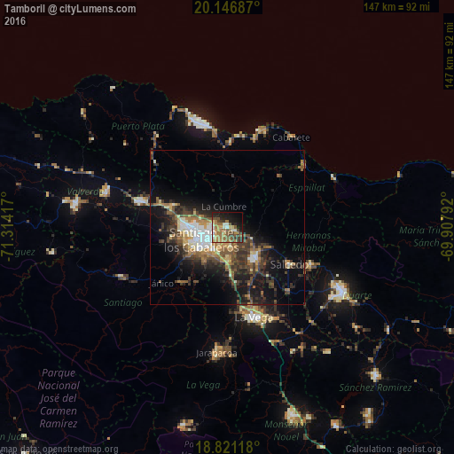
Analysis of Tamboril night lights 2016
Square area 10x10 km:
 1.65%
1.65%90-99
7.44%80-89
5.37%70-79
7.02%60-69
18.39%50-59
8.68%40-49
10.12%30-39
6.4%20-29
8.68%10-19
18.6%0-9
7.64%Square area 50x50 km:
1.7%90-99
2.12%80-89
1.53%70-79
1.81%60-69
3.09%50-59
2.35%40-49
3.48%30-39
4.35%20-29
4.41%10-19
10.66%0-9
64.51%Clear (daylight) street map image can be seen on geolist.org.
Map coordinates:
20° 8' 48.7" North, 71° 18' 51" West
19° 29' 7.4" North, 70° 36' 39.7" West
18° 49' 16.2" North, 69° 54' 28.5" West
Some cities around Tamboril sort by population:
• Santiago de los Caballeros
9.8 km =6.1 mi,  247°
247°
• Moca
13.6 km =8.5 mi,  138°
138°
• Salcedo
23.6 km =14.7 mi,  120°
120°
• Salsipuedes
25.8 km =16 mi,  110°
110°
• Villa González
19.6 km =12.2 mi,  288°
288°
• Licey al Medio
5.9 km =3.7 mi,  168°
168°
• San Víctor Arriba
7.9 km =4.9 mi,  96°
96°
• Sabana Iglesia
24 km =14.9 mi,  220°
220°
3492517 (p: 23,304)
Sources (retrieved 2019-11-25):
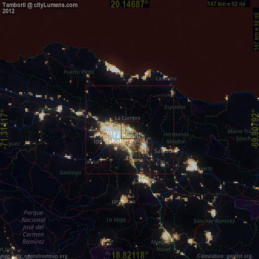
» Earth at Night: Flat Maps 2012, 2016