Santiago de los Caballeros night lights from space
Night Light of Santiago de los Caballeros (Santiago) from space (Dominican Republic) Src. Average luminocity for 10x10km area is 89.5682% and for 50x50km: 17.1581%.
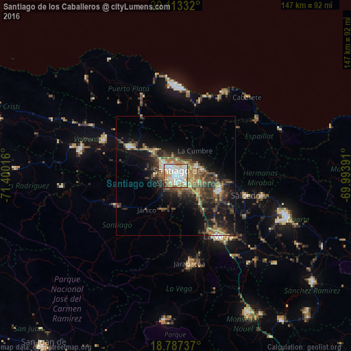
Analysis of Santiago de los Caballeros night lights 2016
Square area 10x10 km:
 34.92%
90-99
29.96%80-89
12.4%70-79
9.5%60-69
8.68%50-59
1.86%40-49
1.03%30-39
1.24%20-29
0.41%10-19
0%0-9
0%Square area 50x50 km:
1.89%90-99
2.23%80-89
1.82%70-79
1.94%60-69
3.27%50-59
2.53%40-49
3.56%30-39
4.73%20-29
4.56%10-19
11.31%0-9
62.18%Clear (daylight) street map image can be seen on geolist.org.
Map coordinates:
20° 6' 48" North, 71° 24' 0.6" West
19° 27' 6.1" North, 70° 41' 49.3" West
18° 47' 14.5" North, 69° 59' 38.1" West
Some cities around Santiago de los Caballeros sort by population:
• Moca
19.1 km =11.9 mi,  109°
109°
• Villa Bisonó
22.5 km =14 mi,  303°
303°
• Tamboril
9.8 km =6.1 mi,  67°
67°
• Río Grande
25 km =15.5 mi,  343°
343°
• Villa González
13.8 km =8.6 mi,  315°
315°
• Licey al Medio
10.4 km =6.5 mi,  101°
101°
• San Víctor Arriba
17.1 km =10.6 mi,  80°
80°
• Sabana Iglesia
15.9 km =9.9 mi,  204°
204°
3492914 (p: 1,200,000)
Sources (retrieved 2019-11-25):
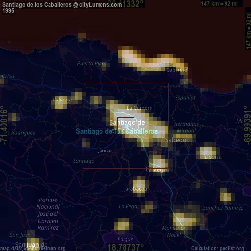
» NASA, Earths city lights 1995
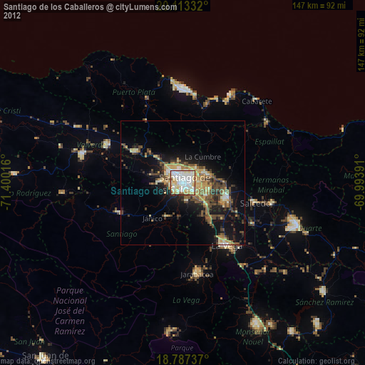
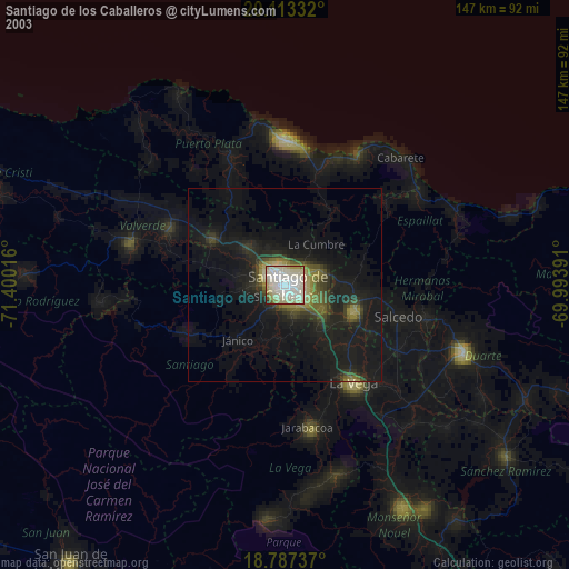
» NASA city lights 2003
» Earth at Night: Flat Maps 2012, 2016