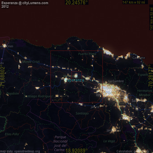
Esperanza night lights from space
Night Light of Esperanza (Valverde) from space (Dominican Republic) Src. Average luminocity for 10x10km area is 17.312% and for 50x50km: 6.4591%.
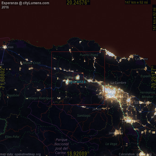
Analysis of Esperanza night lights 2016
Square area 10x10 km:
 1.45%
1.45%90-99
1.86%80-89
0%70-79
6.82%60-69
2.07%50-59
1.03%40-49
1.65%30-39
1.65%20-29
1.24%10-19
5.58%0-9
76.65%Square area 50x50 km:
0.32%90-99
0.79%80-89
0.57%70-79
0.85%60-69
0.89%50-59
0.83%40-49
1.14%30-39
1.78%20-29
1.53%10-19
4.72%0-9
86.6%Clear (daylight) street map image can be seen on geolist.org.
Map coordinates:
20° 14' 44.7" North, 71° 41' 16.9" West
19° 35' 4.9" North, 70° 59' 5.6" West
18° 55' 15.2" North, 70° 16' 54.4" West
Some cities around Esperanza sort by population:
• Mao
10.4 km =6.5 mi,  249°
249°
• Villa Bisonó
11.7 km =7.3 mi,  101°
101°
• Río Grande
24.6 km =15.3 mi,  68°
68°
• Villa González
21.1 km =13.1 mi, 103°
• San José de Las Matas
27.7 km =17.2 mi,  169°
169°
• Imbert
24.9 km =15.5 mi,  40°
40°
• Laguna Salada
12.7 km =7.9 mi,  305°
305°
• Monción
26.1 km =16.2 mi,  222°
222°
3505855 (p: 42,169)
Sources (retrieved 2019-11-25):
» Earth at Night: Flat Maps 2012, 2016