Salcedo night lights from space
Night Light of Salcedo (Hermanas Mirabal) from space (Dominican Republic) Src. Average luminocity for 10x10km area is 13.7355% and for 50x50km: 14.2837%.
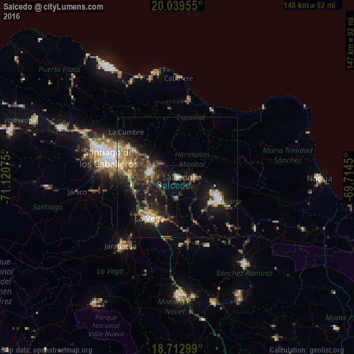
Analysis of Salcedo night lights 2016
Square area 10x10 km:
 0.41%
0.41%90-99
1.03%80-89
1.03%70-79
1.45%60-69
1.86%50-59
0.41%40-49
3.1%30-39
2.27%20-29
5.17%10-19
8.47%0-9
74.79%Square area 50x50 km:
0.82%90-99
1.56%80-89
1.52%70-79
1.71%60-69
2.57%50-59
2.05%40-49
2.88%30-39
3.98%20-29
4.32%10-19
11.92%0-9
66.68%Clear (daylight) street map image can be seen on geolist.org.
Map coordinates:
20° 2' 22.4" North, 71° 7' 14.7" West
19° 22' 39.4" North, 70° 25' 3.4" West
18° 42' 46.8" North, 69° 42' 52.2" West
Some cities around Salcedo sort by population:
• San Francisco de Macorís
19.3 km =12 mi,  116°
116°
• Concepción de La Vega
20.9 km =13 mi,  214°
214°
• Moca
11.5 km =7.1 mi,  278°
278°
• Tamboril
23.6 km =14.7 mi,  300°
300°
• Salsipuedes
5 km =3.1 mi,  51°
51°
• Tenares
7 km =4.3 mi,  92°
92°
• Licey al Medio
20.1 km =12.5 mi,  287°
287°
• San Víctor Arriba
16.6 km =10.3 mi,  311°
311°
3493283 (p: 45,299)
Sources (retrieved 2019-11-25):
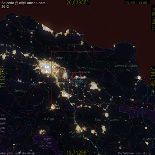
» Earth at Night: Flat Maps 2012, 2016